
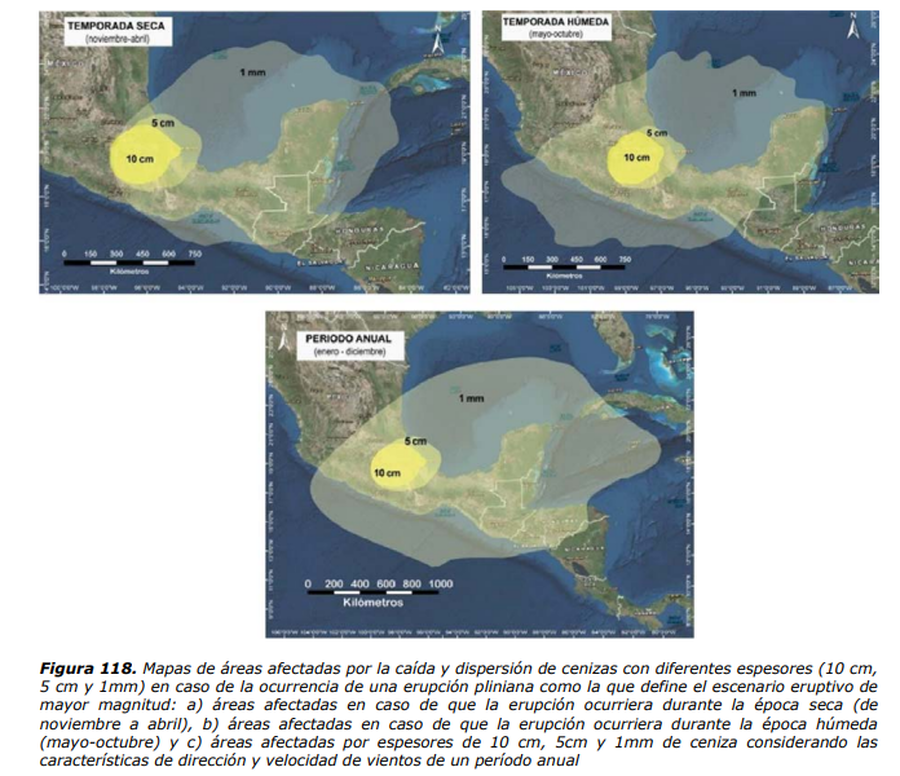
Mapas de áreas afectadas por la caída y dispersión de cenizas con diferentes espesores (10 cm, 5 cm y 1mm) en caso de la ocurrencia de una erupción pliniana como la que define el escenario eruptivo de mayor magnitud
Maps of areas affected by the fall and dispersion of ash with different thicknesses (10 cm, 5 cm and 1 mm) in the event of the occurrence of a plinian eruption such as the one that defines the largest magnitude eruptive scenario
Popocatépetl, Mexico, 2017
Figure 118 in: Martin Del Pozzo, A.L, Alatorre Ibargüengoitia M., Arana Salinas L., Bonasia R., Capra Pedol L., Cassata W., Cordoba G., Cortés Ramos J., Delgado Granados H., Ferrés López M.D., Fonseca Álvarez R., García Reynoso J.A., Gisbert G., Guerrero López D.A., Jaimes Viera M., Macías Vázquez J.L., Nieto Obregon J., Nieto Torres A., Paredes Ruiz P.A., Portocarrero Martínez J., Renne P., Rodríguez Espinosa D.M., Salinas Sánchez S., Siebe Grabach C., & Tellez Ugalde E. (2017). Estudios geológicos y actualización del mapa de peligros del volcán Popocatépetl. Memoria técnica del mapa de peligros del volcán Popocatépetl. Instituto de Geofísica, Universidad Nacional Autónoma de México (UNAM).
This map was produced by an official agency, but may not be the most recent, most complete, or main operational map.
For the current operational hazard map, please consult the proper institutional authorities.
Click on image for full-size map. If link seems broken, try the archived version.
Martin Del Pozzo, A.L, Alatorre lbargüengoitia M., Arana Salinas L., Bonasia R., Capra Pedol L., Cassata W., Cordoba G., Cortés Ramos J., Delgado Granados H., Ferrés López M.D., Fonseca Álvarez R., García Reynoso J.A., Gisbert G., Guerrero López D.A., Jaimes Viera M., Macías Vázquez J.L., Nieto Obregon J., Nieto Torres A., Paredes Ruiz P.A., Portocarrero Martínez J., Renne P., Rodríguez Espinosa D.M., Salinas Sánchez S., Siebe Grabach C., & Tellez Ugalde E. (2016). Mapas de Peligros del Volcán Popocatépetl. Instituto de Geofísica, Universidad Nacional Autónoma de México (UNAM), CENEPRED, SEGOB.Map Set
https://www.geofisica.unam.mx/assets/monografias22.pdf
Other Maps In Set: