
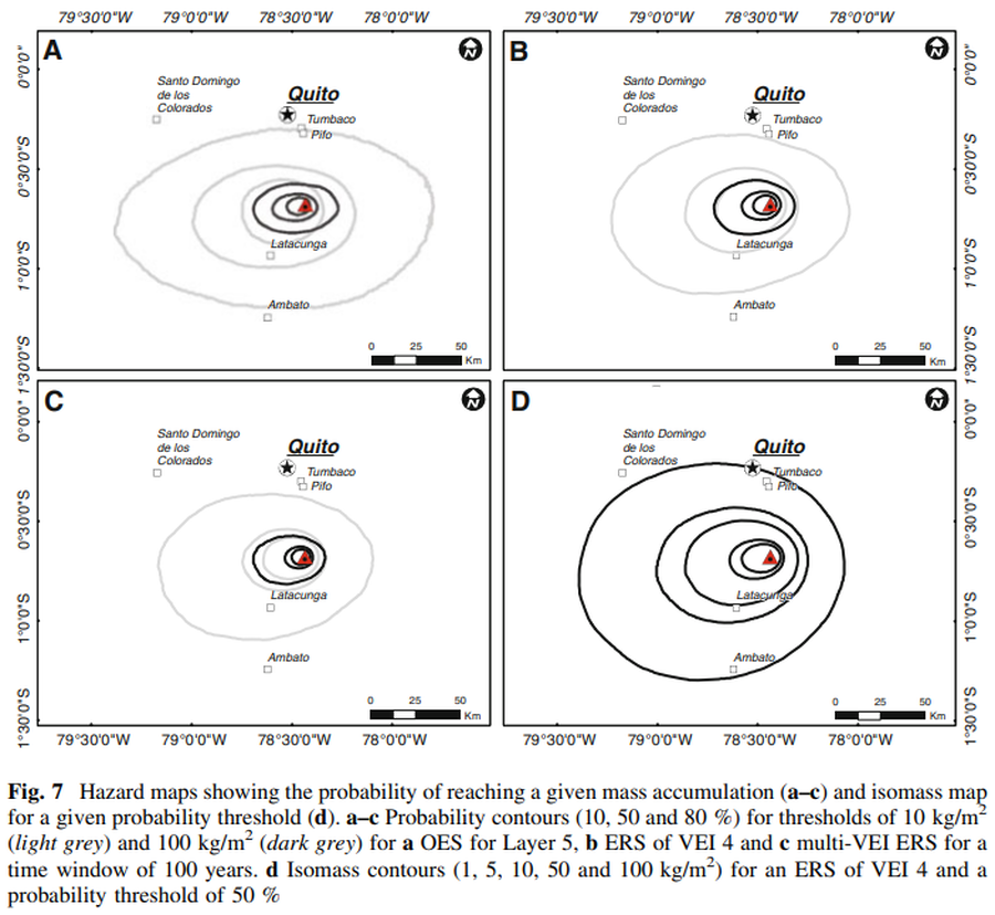
Hazard maps showing the probability of reaching a given mass accumulation (a–c) and isomass map for a given probability threshold (d)
Cotopaxi, Ecuador, 2013
Figure 7 in: Biass, S., & Bonadonna, C. (2013). A fast GIS-based risk assessment for tephra fallout: the example of Cotopaxi volcano, Ecuador. Natural Hazards, 65, 477-495. https://doi.org/10.1007/s11069-012-0378-z
This hazard map is the result of scientific research and was published in academic literature.
It is presented here to serve as an example of the map type or the map-making methodology. It is NOT the official, operational map. For the current operational hazard map, please consult the proper institutional authorities.
Click on thumbnail for full-size map. We do not have copyright permission to display the full-size image. If you are the copyright holder and wish to provide copyright, please contact us at admin@volcanichazardmaps.org. If link seems broken, try the archived version.