
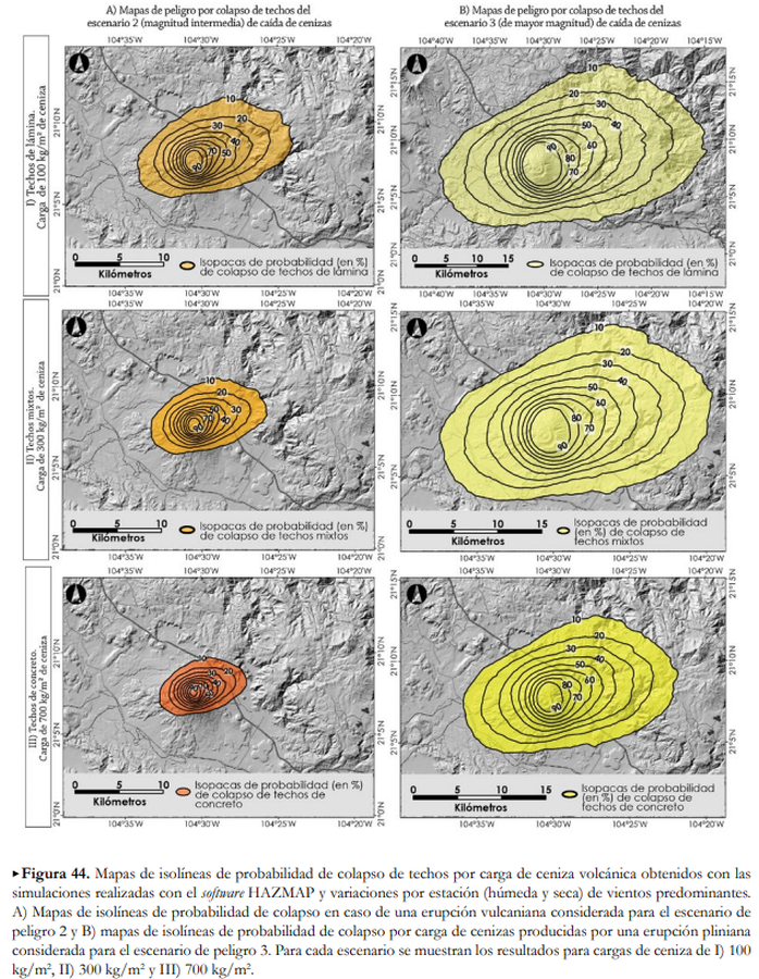
Mapas de isolíneas de probabilidad de colapso de techos por carga de ceniza volcánica obtenidos con las simulaciones realizadas con el software HAZMAP y variaciones por estación (húmeda y seca) de vientos predominantes
Maps of isolines of probability of collapse of roofs due to volcanic ash load obtained with the simulations carried out with the HAZMAP software and variations by season (wet and dry) of prevailing winds
Ceboruco, Mexico, 2019
Figure 44 in: Ferrés López, D., Sieron, K., González Zuccolotto, K., Constantinescu, R., Agustín Flores, J., Siebe Grabach, C., Capra Pedol, L., Connor, L., & Connor, C.B. (2019). Memoria técnica del mapa de peligros del volcán Ceboruco (Nayarit). Monografías del Instituto de Geofísica, 24.
This map was produced by an official agency, but may not be the most recent, most complete, or main operational map.
For the current operational hazard map, please consult the proper institutional authorities.
Click on image for full-size map. If link seems broken, try the archived version.
Ferrés Lopez, D., Sieron, K., González Zuccolotto, K., Constantinescu, R., Agustín Flores, J., Siebe, C., Capra, L., Connor, L., & Connor, C.B. (2019). Memoria técnica del mapa de peligros del volcán Ceboruco (Nayarit). Monografías del Instituto de Geofísica, 24. Map Set
https://www.geofisica.unam.mx/recursos/docs/editorial/IGEF_monografias_24.pdf
Other Maps In Set: