Land use area map. Land use areas according to the basic policy of the 2000 Mt. Usu eruption disaster recovery plan.
Usu (Toya), Japan, 2002
Figure 8-9 in: Nakao, M. (2005). Eruption of Mt Usu, March 31 st 2000, at Mt Usu in Hokkaido. In: Failure Knowledge Database, 100 Selected Cases. http://www.shippai.org/fkd/en/cfen/CA1000619.html. Reprinted from: The Hokkaido Shimbun Press. (2002) 2000-Nen Usu-Zan Funka (The 2000 Mt. Usu Eruption). The Hokkaido Shimbun Press.
This map was produced by an official agency, but is NOT the most recent, most complete, or main operational map.
For the current operational hazard map, please consult the proper institutional authorities.
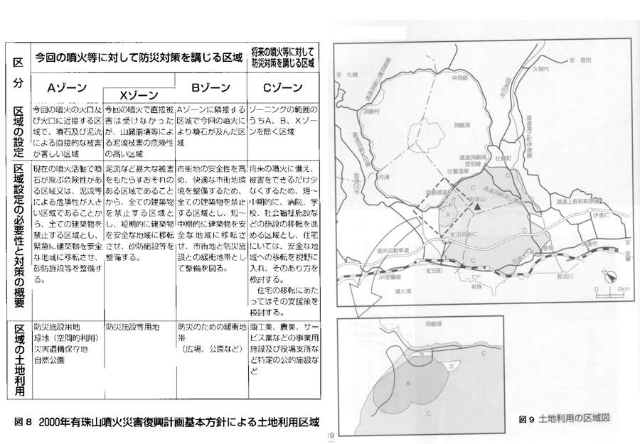
Click on image for full-size map. If link seems broken, try the archived version.
Nakao, M. (2005). Eruption of Mt Usu, March 31 st 2000, at Mt Usu in Hokkaido. Failure Knowledge Database, 100 Selected Cases.Map Set
http://www.shippai.org/fkd/en/cfen/CA1000619.html
Other Maps In Set:
Map Data
Map ID 3856 Hazard Process(es) Access or danger zone; Ballistics; Lahars; Vent-opening hazards Hazard Zone Presentation Hazard level-focused: All or most hazards are combined by hazard level on a main map and series of insets Temporal Scale Background, or long-term, map Spatial Scale Volcano and surrounding area Publication Format Map on website Zonation Method(s) Geologic history Zonation Model(s) Scenario(s) Considered No scenarios were discernable from the map Hazard Zone Label(s) Access (exclusion, danger, or safe zones) Probability Definition(s) Qualitative relative probability (e.g. high-medium-low) Purpose Land-use planning: Intended to inform citing of facilities, building restrictions, resource management, and infrastructure development Audience Land-use planners, city planners, government officials, etc. Language(s) Japanese Basemap(s) Street map Basemap overlay(s) Diemsionality Planimetric (2D or map) view Color Scheme Dark to Light (greyscale)