
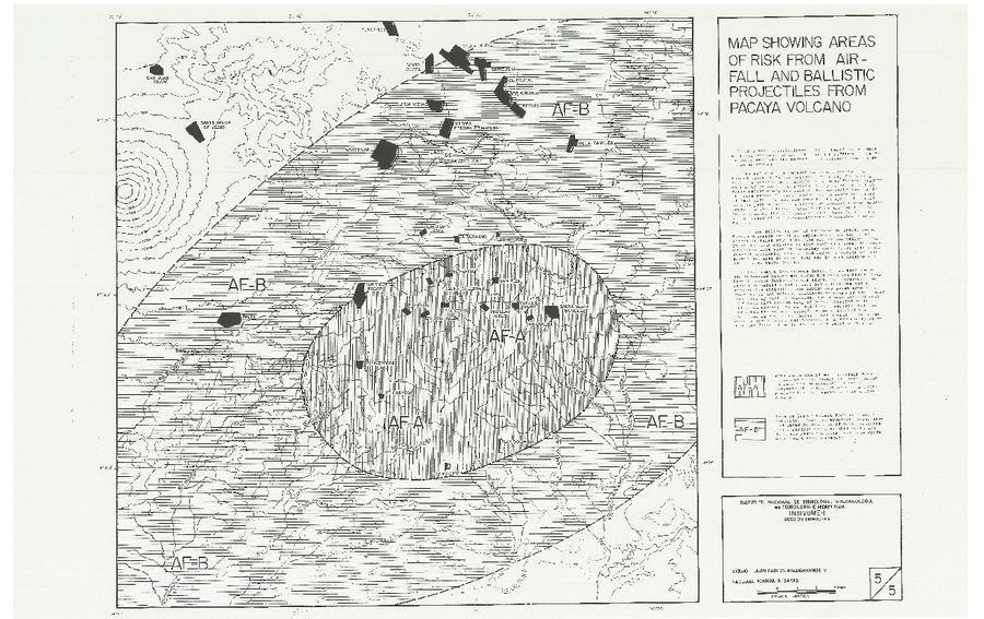
Map Showing Areas of Risk from Airfall and Ballistic Projectiles from Pacaya Volcano
Pacaya, Guatemala, 1987
Map 5 in: Banks, N. (1987). Preliminary Assessment Of The Volcano Hazards Of Pacaya Volcano Guatemala. USGS/INSIVUMEH. 8pp. https://pdf.usaid.gov/pdf_docs/pnaec775.pdf
This map was produced by an official agency, but is NOT the most recent, most complete, or main operational map.
For the current operational hazard map, please consult the proper institutional authorities.
Map Set
Banks, N. (1987). Preliminary Assessment Of The Volcano Hazards Of Pacaya Volcano Guatemala. USGS/INSIVUMEH. 8pp. https://pdf.usaid.gov/pdf_docs/pnaec775.pdf
https://pdf.usaid.gov/pdf_docs/pnaec775.pdf
Other Maps In Set: