
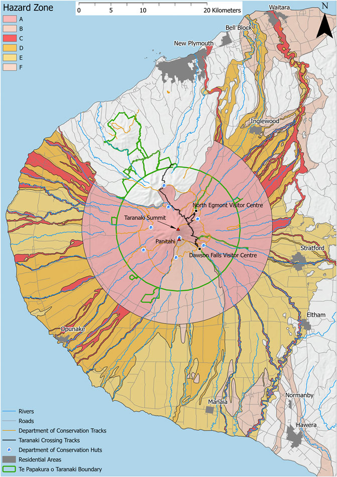
Taranaki volcanic hazard map and zones from Neall and Alloway (1996)
Taranaki, New Zealand, 2022
Figure 2 in: Mead, S., Procter, J., Bebbington, M., & Rodriguez-Gomez, C. (2022). Probabilistic Volcanic Hazard Assessment for National Park Infrastructure Proximal to Taranaki Volcano (New Zealand). Frontiers in Earth Science, 435. https://doi.org/10.3389/feart.2022.832531. Simplified from: Neall, V. E., & Alloway, B. V. (1996). Volcanic hazard map of Western Taranaki. Massey University, Department of Soil Science Report, 12.
This hazard map is the result of scientific research and was published in academic literature.
It is presented here to serve as an example of the map type or the map-making methodology. It is NOT the official, operational map. For the current operational hazard map, please consult the proper institutional authorities.
Click on image for full-size map.
Map Set
Mead, S., Procter, J., Bebbington, M., & Rodriguez-Gomez, C. (2022). Probabilistic Volcanic Hazard Assessment for National Park Infrastructure Proximal to Taranaki Volcano (New Zealand). Frontiers in Earth Science, 435. https://doi.org/10.3389/feart.2022.832531
https://doi.org/10.3389/feart.2022.832531
Other Maps In Set:
- Exceedance probability for volcanic mass flows reaching or travelling further than Taranaki crossing track following a VEI≤2 eruption
- Count of ballistic particle impacts per 10,000 ballistic particles with a diameter of 256 mm
- Minimum factor of safety for Mt. Taranaki edifice
- Potential failure volumes for FOS <3.0 at Mt. Taranaki