
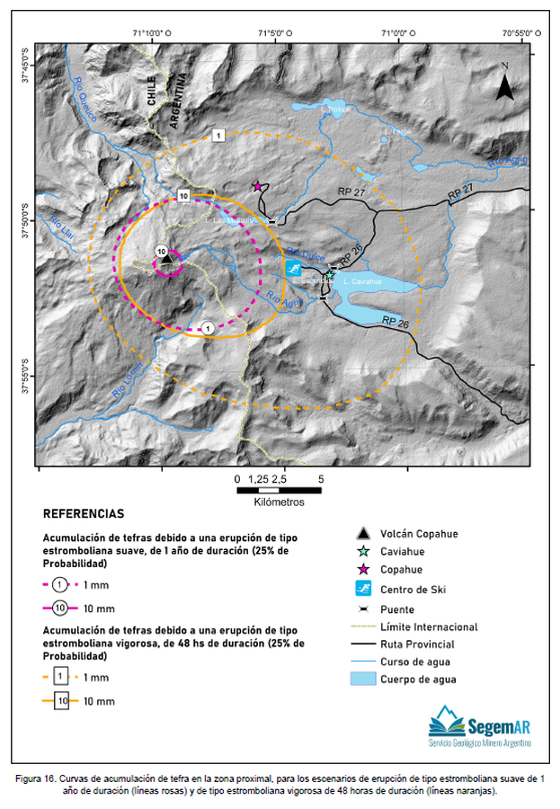
Curvas de acumulación de tefra en la zona proximal, para los escenarios de erupción de tipo estromboliana suave de 1 año de duración (líneas rosas) y de tipo estromboliana vigorosa de 48 horas de duración (líneas naranjas)
Tephra accumulation curves in the proximal zone, for the mild Strombolian type eruption scenarios lasting 1 year (pink lines) and the vigorous Strombolian type erupting for 48 hours (orange lines)
Copahue, Chile-Argentina, 2023
Figure 16 in: Kaufman, J. F., Elissondo, M., Sruoga, P., Yamín, M. G. 2023. Peligrosidad del volcán Copahue. Provincia del Neuquén, República Argentina. Serie de Contribuciones Técnicas Peligrosidad Geológica N° 24. 51 pp. Buenos Aires, Servicio Geológico Minero Argentino (SEGEMAR). Instituto de Geología y Recursos Minerales.
This map was produced by an official agency, but may not be the most recent, most complete, or main operational map.
For the current operational hazard map, please consult the proper institutional authorities.
Click on thumbnail for full-size map. We do not have copyright permission to display the full-size image. If you are the copyright holder and wish to provide copyright, please contact us at admin@volcanichazardmaps.org. If link seems broken, try the archived version.
Kaufman, J. F., Elissondo, M., Sruoga, P., Yamín, M. G. 2023. Peligrosidad del volcán Copahue. Provincia del Neuquén, República Argentina. Serie de Contribuciones Técnicas Peligrosidad Geológica N° 24. 51 pp. Buenos Aires, Servicio Geológico Minero Argentino (SEGEMAR). Instituto de Geología y Recursos Minerales.Map Set
https://repositorio.segemar.gov.ar/handle/308849217/4308
Other Maps In Set: