
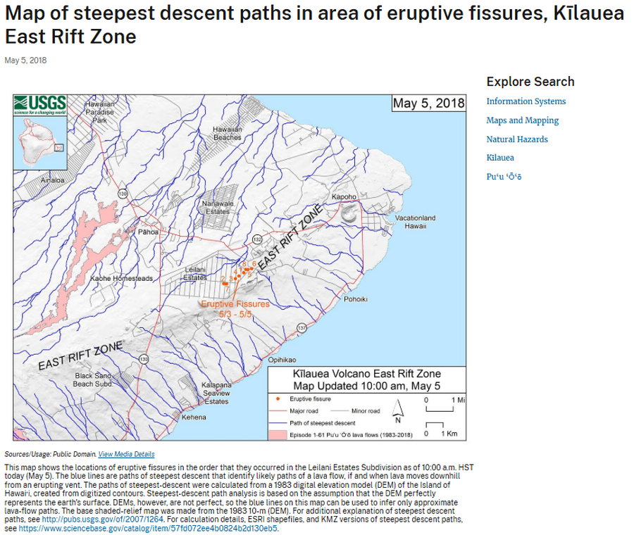
Map of steepest descent paths in area of eruptive fissures, Kīlauea East Rift Zone
Kilauea, United States, 2018
U.S. Geological Survey (USGS). (2018). Map of steepest descent paths in area of eruptive fissures, Kīlauea East Rift Zone. U.S. Geological Survey. https://www.usgs.gov/maps/map-steepest-descent-paths-area-eruptive-fissures-kilauea-east-rift-zone
This map was produced by an official agency, but is NOT the most recent, most complete, or main operational map.
For the current operational hazard map, please consult the proper institutional authorities.
Click on image for full-size map. If link seems broken, try the archived version.
https://www.usgs.gov/volcanoes/kilauea/mapsMap Set
Other Maps In Set: