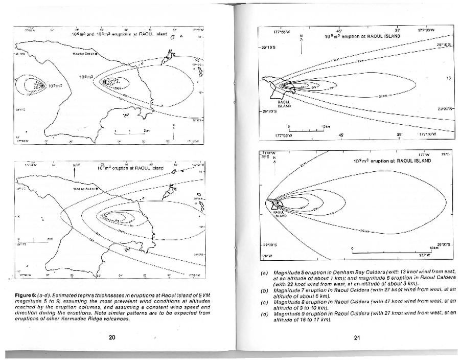
Estimated tephra thickness in eruptions at Raoul Island of EVM magnitude 5 to 9
Raoul Island, New Zealand, 1992
Figure 6 in: Latter, J. H., Lloyd, E. F., Smith, I. E. M., Nathan, S. (1992). Volcanic Hazards in the Kermadec Islands, and at Submarine Volcanoes between Southern Tonga and New Zealand. Volcanic Hazards Information Series No. 4. Volcanic Hazards Working Group of the Scientific Advisory Committee, Ministry of Civil Defence. pp. 44.
This map was produced by an official agency, but may not be the most recent, most complete, or main operational map.
For the current operational hazard map, please consult the proper institutional authorities.

Map Set
Map Data
Map ID 4262 Hazard Process(es) Tephra fall Hazard Zone Presentation Single hazard: A single hazard process is represented on a main map panel Temporal Scale Background, or long-term, map Spatial Scale Island Publication Format Figure in a hazard assessment or mitigation plan Zonation Method(s) Geologic history Zonation Model(s) Scenario(s) Considered Season or weather; Size, VEI, or intensity Hazard Zone Label(s) Estimated value or Hazard Impact Metric Probability Definition(s) No probability definition was discernable from the map Purpose Hazard awareness: Intended for educating the audience about the extent and probability of volcanic hazard Audience General public and/or media Language(s) English Basemap(s) Simple or sketch map Basemap overlay(s) Diemsionality Planimetric (2D or map) view Color Scheme Symbols and/or lines only