
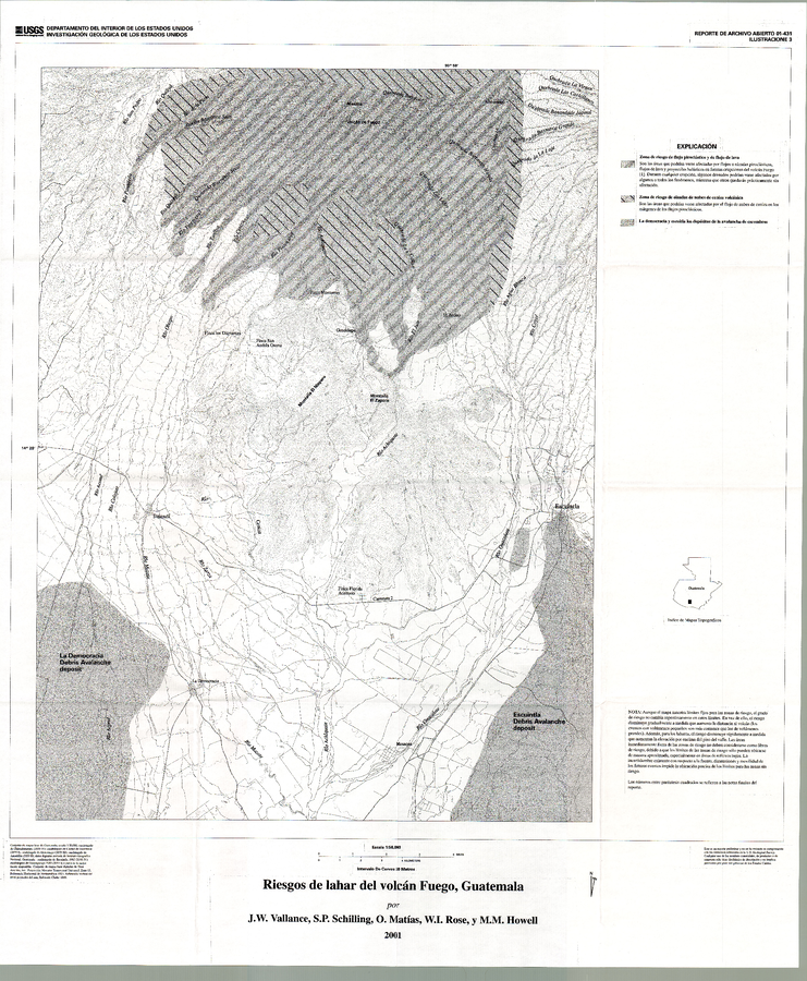
Riesgos de Lahar del Volcán Fuego, Guatemala [Peligros volcánicos del Volcán de Fuego, Guatemala]
Lahar Hazards from Fuego Volcano, Guatemala [Volcanic Hazards from Fuego Volcano, Guatemala]
Fuego, Guatemala, 2001
Plate 3 in: Vallance, J.W., Schilling, S.P., Matías, O., Rose, W.I. & Howell, M.M. (2001). Riesgos Volcánicos en Los Volcanes Fuego and Acatenango, Guatemala. U.S. Geological Survey, Reporte de archivo abierto 01-431.
This map was produced by an official agency of a foreign government, but is NOT the most recent, most complete, or main operational map.
For the current operational hazard map, please consult the proper institutional authorities.
Map Set
Vallance, J.W., Schilling, S.P., Matías, O., Rose, W.I. & Howell, M.M. (2001). Volcano Hazards at Fuego and Acatenango, Guatemala. U.S. Geological Survey, Open-File Report 01-431. https://doi.org/10.3133/ofr01431
https://doi.org/10.3133/ofr01431
Other Maps In Set:
- Lahar Hazards of Acatenango Volcano, Guatemala
- Volcano hazards of Acatenango Volcano, Guatemala
- Lahar Hazards of Fuego Volcano, Guatemala
- Volcano Hazards of Fuego Volcano, Guatemala
- Lahar Hazards of Fuego Volcano, Guatemala
- Riesgos de Lahar del Volcán Fuego, Guatemala
- Riesgos de Lahar del Volcán Acatenango, Guatemala
- Riesgos de Lahar del Volcán Acatenango, Guatemala [Peligros volcánicos del Volcán Acatenango, Guatemala]