← Back to Search Results

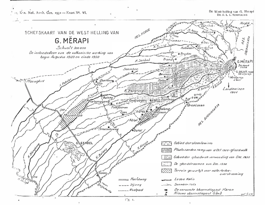
SCHETSKAART VAN DE WESTELIJKE HELLING VAN G. MERAPI. De invloedssfeer van de vulkanische activiteit van begin augustus 1920 tot eind 1930.

Sketch map of the west slope of G. Merapi. The sphere of influence of the volcanic activity from early August 1920 and late 1930.

Merapi, Indonesia, 1931

Figure 1 in: Kemmerling, G. L. L. (1931). Beschouwingen over de hernieuwde werking van den Merapi der vorstenlanden van December 1930. Koninkl. Nederl. Aardrijksk. Genoot. Tijdschr, 48, 712-743.


This map was produced by an official agency, but is NOT the most recent, most complete, or main operational map. For the current operational hazard map, please consult the proper institutional authorities.

Map Data

Map ID4281
Hazard Process(es)Lahars
Hazard Zone PresentationSingle hazard: A single hazard process is represented on a main map panel
Temporal ScaleBackground, or long-term, map
Spatial ScalePart of volcano (flank or drainage)
Publication FormatFigure in a hazard assessment or mitigation plan
Zonation Method(s)Geologic history
Zonation Model(s)
Scenario(s) ConsideredNo scenarios were discernable from the map
Hazard Zone Label(s)Hazard process name
Probability Definition(s)No probability definition was discernable from the map
PurposeScientific interest: Intended for scientific research and general scientific interest; usually published in academic journals
AudienceScientists (usually in scientific publication)
Language(s)Dutch
Basemap(s)Simple or sketch map
Basemap overlay(s)
DiemsionalityPlanimetric (2D or map) view
Color SchemeSymbols and/or lines only
Volcanic Alert Level System
Go to Global Volcanism Program page for Merapi →