← Back to Search Results

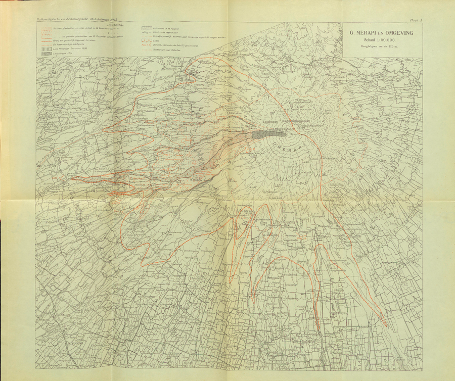
G. Merapi en Omgeving

G. Merapi and Surroundings

Merapi, Indonesia, 1933

Plate 1 in: Neumann van Padang, M. (1933). De uitbarsting van den Merapi: (Midden java) in de jaren 1930-1931. Vukanologische en Seismologische Mededeelingen, No. 12.


This map was produced by an official agency, but is NOT the most recent, most complete, or main operational map. For the current operational hazard map, please consult the proper institutional authorities.

Map Data

Map ID4282
Hazard Process(es)Access or danger zone; PDCs
Hazard Zone PresentationHazard level-focused: All or most hazards are combined by hazard level on a main map panel
Temporal ScaleBackground, or long-term, map
Spatial ScalePart of volcano (flank or drainage)
Publication FormatPoster-style map insert in hazard assessment
Zonation Method(s)Geologic history
Zonation Model(s)
Scenario(s) ConsideredNo scenarios were discernable from the map
Hazard Zone Label(s)Access (exclusion, danger, or safe zones)
Probability Definition(s)No probability definition was discernable from the map
PurposeScientific interest: Intended for scientific research and general scientific interest; usually published in academic journals
AudienceScientists (usually in scientific publication)
Language(s)Dutch
Basemap(s)Contour lines
Basemap overlay(s)Street map
DiemsionalityPlanimetric (2D or map) view
Color SchemeSingle color
Volcanic Alert Level System
Go to Global Volcanism Program page for Merapi →