
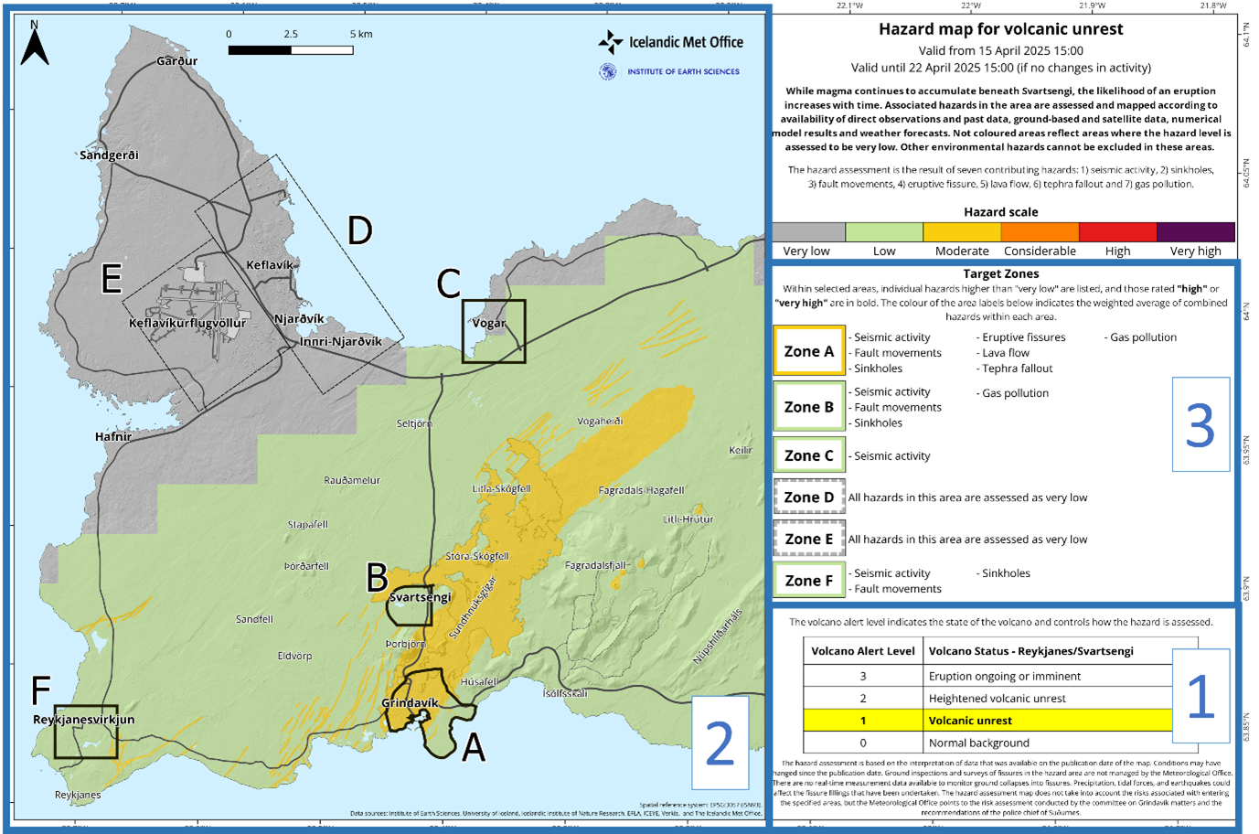
Hazard map for volcanic unrest
Svartsengi (Reykjanes), Iceland, 2025
Icelandic Meteorological Office (IMO). (2025). New hazard map covering a larger area, 15 April 2025. https://en.vedur.is/about-imo/news/uplift-continues-beneath-svartsengi
This map was produced by an official agency, but is NOT the most recent, most complete, or main operational map.
For the current operational hazard map, please consult the proper institutional authorities.
Click on thumbnail for full-size map. We do not have copyright permission to display the full-size image. If you are the copyright holder and wish to provide copyright, please contact us at admin@volcanichazardmaps.org. If link seems broken, try the archived version.
Map Data
Map ID 4291 Hazard Process(es) Deformation hazards; Earthquakes; Gas; Lava flows; Tephra fall; Vent-opening hazards Hazard Zone Presentation Hazard level-focused: All or most hazards are combined by hazard level on a main map panel Temporal Scale Very short-term crisis map (hours to days)
Spatial Scale Volcano and surrounding area Publication Format Map on website Zonation Method(s) Geologic history; Monitoring; Scenario modeling Zonation Model(s) Scenario(s) Considered Current conditions Hazard Zone Label(s) Qualitative relative probability (e.g. high-medium-low) Probability Definition(s) Qualitative relative probability (e.g. high-medium-low) Purpose Multiple: intended for multiple purposes including general hazard awareness, planning, and crisis management Audience Multiple audiences (usually the public, civil authorities, and land-use planners) Language(s) English Basemap(s) Hillshade Basemap overlay(s) Street map Diemsionality Planimetric (2D or map) view Color Scheme Purple to Green Volcanic Alert Level System https://global-valid.org/val-iceland-65/