
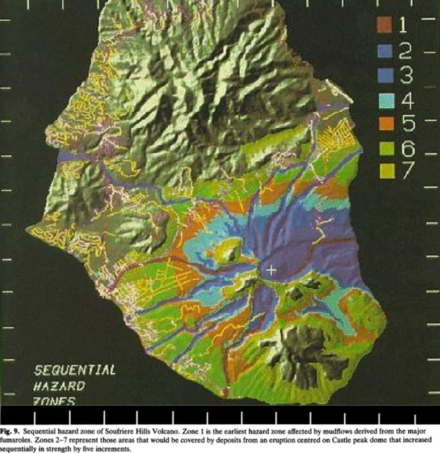
Sequential hazard zoneof Soufriere Hills Volcano
Soufrière Hills, Montserrat [United Kingdom], 1988
Figure 9 in: Wadge, G. & Isaacs, M. C. (1988). Mapping the volcanic hazards from Soufriere Hills Volcano, Montserrat, West Indies using an image processor. Journal of the Geological Society, 145 (4) 541-551. https://doi.org/10.1144/gsjgs.145.4.0541
This hazard map is the result of scientific research and was published in academic literature.
It is presented here to serve as an example of the map type or the map-making methodology. It is NOT the official, operational map. For the current operational hazard map, please consult the proper institutional authorities.
Click on thumbnail for full-size map. We do not have copyright permission to display the full-size image. If you are the copyright holder and wish to provide copyright, please contact us at admin@volcanichazardmaps.org.