
← Back to Search Results

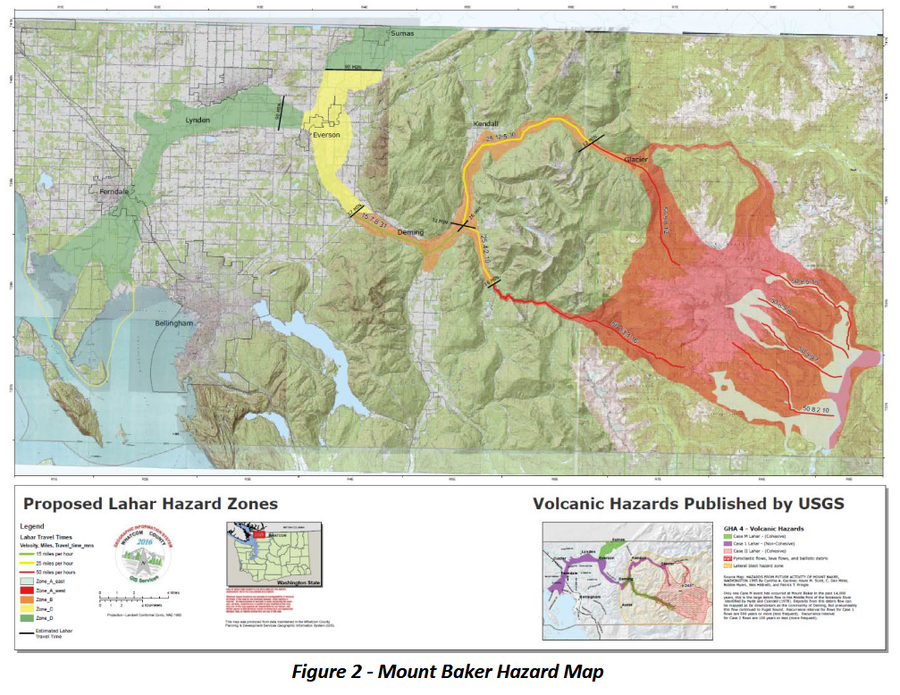
Mount Baker Hazard Map

Baker, United States, 2019

Figure 2 in: Whatcom County Sheriff’s Office Division of Emergency Management. (2109). Mount Baker Volcano Action Plan.


This map was produced by an official agency, but may not be the most recent, most complete, or main operational map. For the current operational hazard map, please consult the proper institutional authorities.

Click on thumbnail for full-size map. We do not have copyright permission to display the full-size image. If you are the copyright holder and wish to provide copyright, please contact us at admin@volcanichazardmaps.org.

Map Data

Map ID4335
Hazard Process(es)Lahars
Hazard Zone PresentationSingle hazard: A single hazard process is represented on a main map panel
Temporal ScaleCrisis, or short-term, map (hours to decades)
Spatial ScaleVolcano and surrounding area
Publication FormatFigure in a hazard assessment or mitigation plan
Zonation Method(s)Derived/simplified from another map; Geologic history
Zonation Model(s)
Scenario(s) ConsideredSize, VEI, or intensity
Hazard Zone Label(s)Hazard process name
Probability Definition(s)No probability definition was discernable from the map
PurposeCrisis management and response: Intended to be used for managing, responding to, and taking action during an eruption; often includes evacuation routes, access restrictions, actions to take, etc.
AudienceCivil protection authorities (emergency managers, first responders, etc.)
Language(s)English
Basemap(s)Topographic map (colored contour map)
Basemap overlay(s)
DiemsionalityPlanimetric (2D or map) view
Color SchemeRed to Blue
Volcanic Alert Level System
Go to Global Volcanism Program page for Baker →