
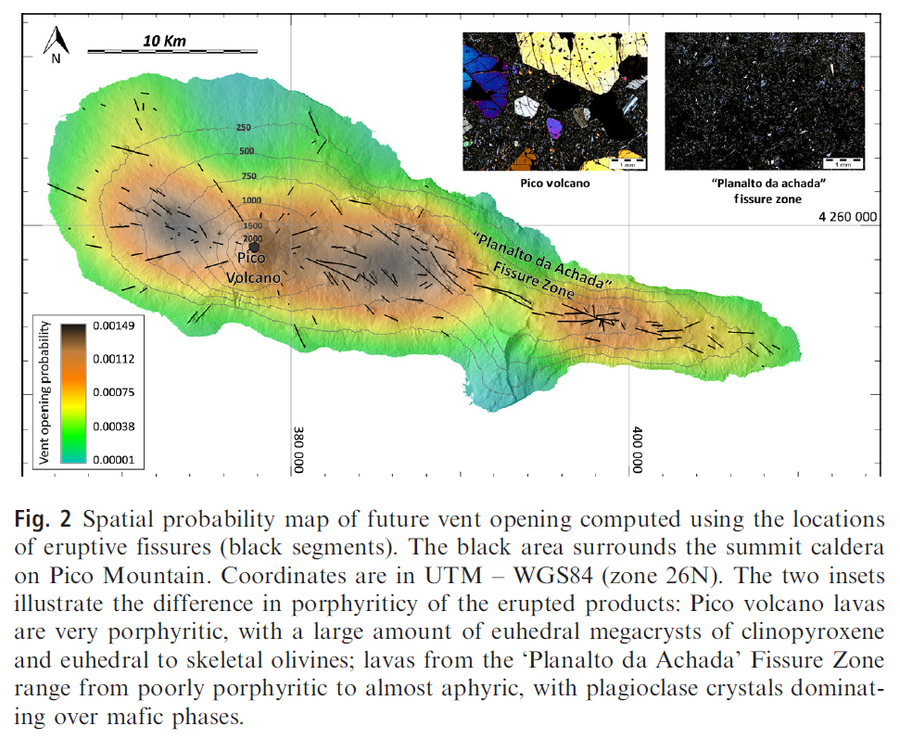
Spatial probability map of future vent opening computed using the locations of eruptive fissures (black segments)
Pico, Azores [Portugal], 2015
Figure 2 in: Cappello, A., Zanon, V., Del Negro, C., Ferreira, T. J., & Queiroz, M. G. (2015). Exploring lava‐flow hazards at Pico Island, Azores Archipelago (Portugal). Terra Nova, 27(2), 156-161.
This hazard map is the result of scientific research and was published in academic literature.
It is presented here to serve as an example of the map type or the map-making methodology. It is NOT the official, operational map. For the current operational hazard map, please consult the proper institutional authorities.
Click on image for full-size map.
Map Set
Cappello, A., Zanon, V., Del Negro, C., Ferreira, T. J., & Queiroz, M. G. (2015). Exploring lava‐flow hazards at Pico Island, Azores Archipelago (Portugal). Terra Nova, 27(2), 156-161.
https://doi.org/10.1111/ter.12143
Other Maps In Set: