
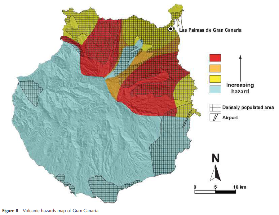
Volcanic hazards map of Gran Canaria
Gran Canaria, Canary Islands [Spain], 2009
Figure 8 in: Rodriguez‐Gonzalez, A., Fernandez‐Turiel, J. L., Perez‐Torrado, F. J., Hansen, A., Aulinas, M., Carracedo, J. C., ... & Paterne, M. (2009). The Holocene volcanic history of Gran Canaria island: implications for volcanic hazards. Journal of Quaternary Science: Published for the Quaternary Research Association, 24(7), 697-709.
This hazard map is the result of scientific research and was published in academic literature.
It is presented here to serve as an example of the map type or the map-making methodology. It is NOT the official, operational map. For the current operational hazard map, please consult the proper institutional authorities.
Click on thumbnail for full-size map. We do not have copyright permission to display the full-size image. If you are the copyright holder and wish to provide copyright, please contact us at admin@volcanichazardmaps.org.