
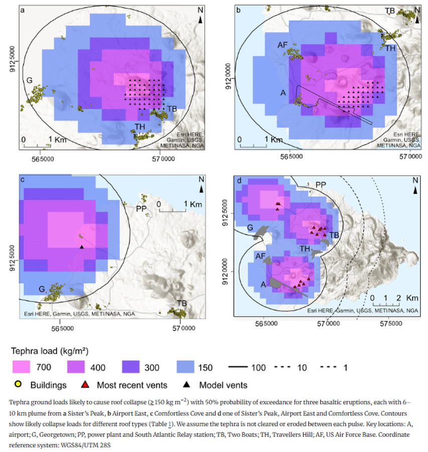
Tephra ground loads likely to cause roof collapse (≥ 150 kg m−2) with 50% probability of exceedance for three basaltic eruptions
Ascension, Ascension Island [United Kingdom], 2024
Figure 8 in: Osman, S., Crummy, J., Thomas, M., & Carver, S. (2024). Probabilistic hazard analyses for a small island: methods for quantifying tephra fall hazard and appraising possible impacts on Ascension Island. Bulletin of Volcanology, 86(10), 82.
This hazard map is the result of scientific research and was published in academic literature.
It is presented here to serve as an example of the map type or the map-making methodology. It is NOT the official, operational map. For the current operational hazard map, please consult the proper institutional authorities.
Click on image for full-size map. If link seems broken, try the archived version.
Osman, S., Crummy, J., Thomas, M., & Carver, S. (2024). Probabilistic hazard analyses for a small island: methods for quantifying tephra fall hazard and appraising possible impacts on Ascension Island. Bulletin of Volcanology, 86(10), 82.Map Set
https://doi.org/10.1007/s00445-024-01771-3
Other Maps In Set: