
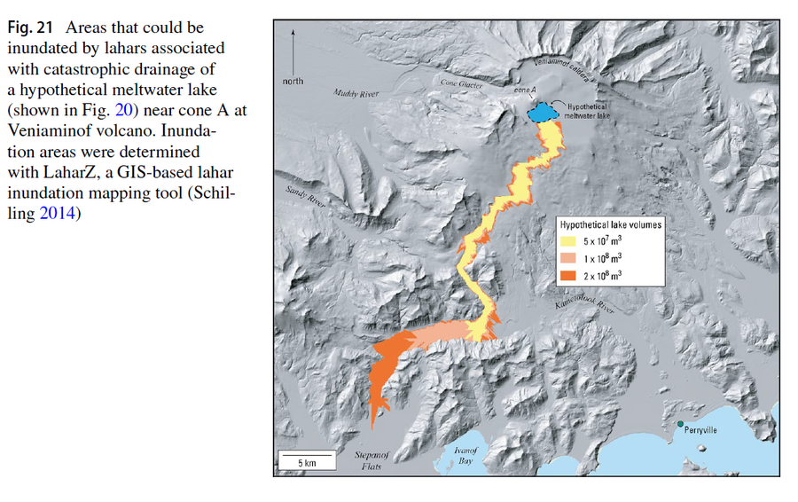
Areas that could be inundated by lahars associated with catastrophic drainage of a hypothetical meltwater lake (shown in Fig. 20) near cone A at Veniaminof volcano
Veniaminof, United States, 2023
Figure 21 in: Waythomas, C. F., Edwards, B. R., Miller, T. P., & McGimsey, R. G. (2023). Lava-ice interactions during historical eruptions of Veniaminof Volcano, Alaska and the potential for meltwater floods and lahars. Natural Hazards, 115(1), 73-106.
This hazard map is the result of scientific research and was published in academic literature.
It is presented here to serve as an example of the map type or the map-making methodology. It is NOT the official, operational map. For the current operational hazard map, please consult the proper institutional authorities.
Click on image for full-size map. If link seems broken, try the archived version.