
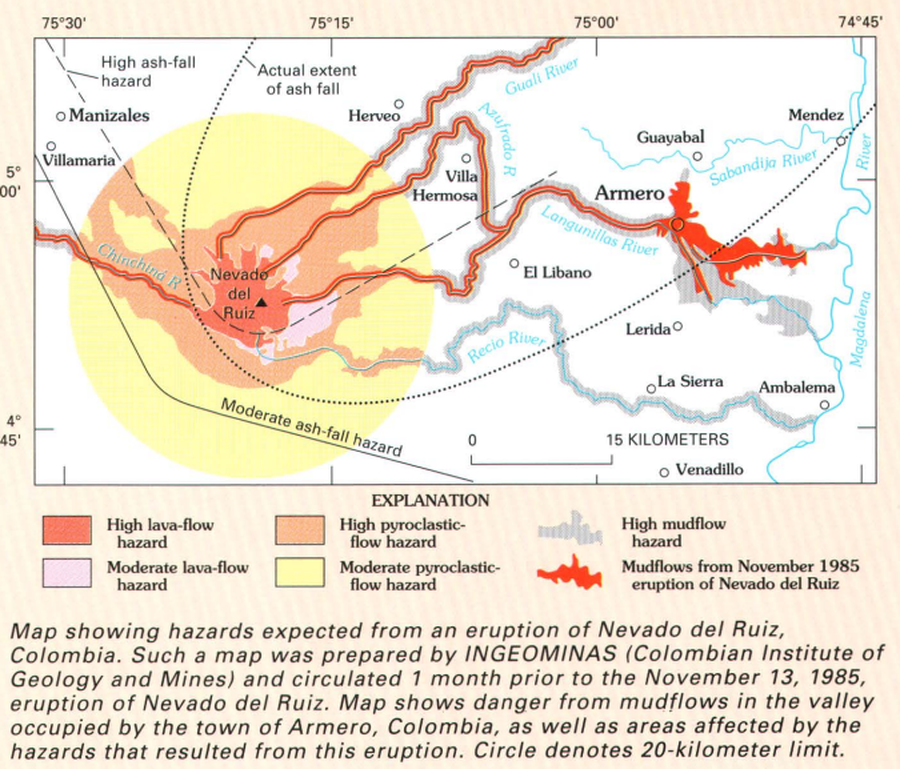
Map showing hazards expected from an eruption of Nevado del Ruiz, Colombia
Nevado del Ruiz, Colombia, 1992
Page 21 in: Wright, T. L., & Pierson, T. C. (1992). Living with volcanoes. US Geological Survey, Circular 1073. https://doi.org/10.3133/cir1073
This map was produced by an official agency of a foreign government, but is NOT the most recent, most complete, or main operational map.
For the current operational hazard map, please consult the proper institutional authorities.
Click on image for full-size map. If link seems broken, try the archived version.