
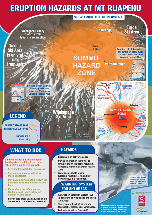
Eruption Hazards at Mt. Ruapehu
Ruapehu, New Zealand, 2008
GNS Science (compiler). (2008). Eruption Hazards at Mt. Ruapehu.
This map was produced by an official agency, but is NOT the most recent, most complete, or main operational map.
For the current operational hazard map, please consult the proper institutional authorities.
Click on image for full-size map. If link seems broken, try the archived version.
Department of Conservation. (Year Unknown). Volcanic risk in Tongariro National Park. Old versions. https://www.doc.govt.nz/Documents/parks-and-recreation/tracks-and-walks/Map Set
https://www.doc.govt.nz/Documents/parks-and-recreation/tracks-and-walks/
Other Maps In Set: