
Hazard Zonation Map for Mount St. Helens
St. Helens, United States, 2003
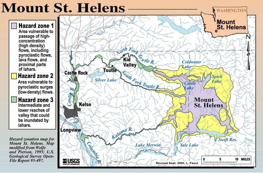
Faust, L. (2003). Hazard zonation map for Mount St. Helens. U.S. Geological Survey. (Simplified from: Wolfe & Pierson 1995) (Reprinted in: Bluth, G. (Year Unknown). Mt. St. Helens Activity Update (+ 2004 events). Michigan Technological University, GE4150 Lecture. https://pages.mtu.edu/~gbluth/Teaching/GE4150/lecture_pdfs/L11_msh_seismic.pdf#page=2)
This map was produced by an official agency, but is NOT the most recent, most complete, or main operational map.
For the current operational hazard map, please consult the proper institutional authorities.
Click on image for full-size map. If link seems broken, try the archived version.