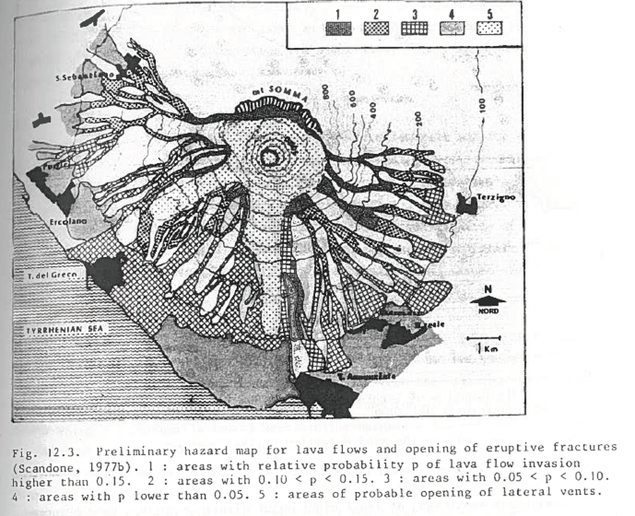
Preliminary hazard map for lava flows and opening of eruptive fractures
Vesuvius, Italy, 1977
Figure 12.3 (in reprint) in: Scandone, R. (1977). Il rischio di colate di lava e implicazioni socio-economiche. Proceedings of the Congress: I Vulcani Attivi dell'Area Napoletana, Naples (23-25 June 1977) (Reprinted in: Barberi, F., Rosi, M., Santacroce, R., & Sheridan, M.F. (1983). Volcanic hazard zonation: Mt. Vesuvius. In: Tazieff, H. & Sabroux, J.-C. (Eds.) Forecasting Volcanic Events, Elsevier, Amsterdam, p. 149-161.
This hazard map is the result of scientific research and was published in academic literature.
It is presented here to serve as an example of the map type or the map-making methodology. It is NOT the official, operational map. For the current operational hazard map, please consult the proper institutional authorities.