
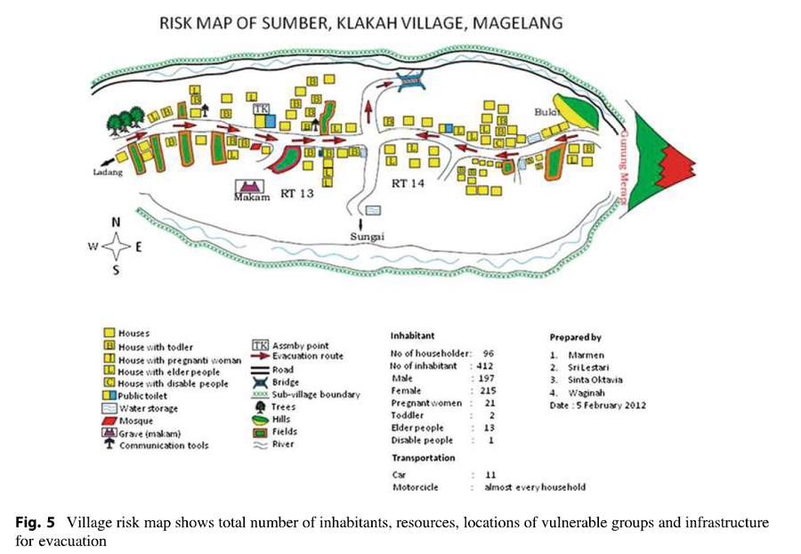
Risk Map of Sumber, Klakah Village, Magelang
Merapi, Indonesia, 2012
Figure 5 (in reprint) in: Marmen, Sri Lestari, Sinta Oktavia, & Waginah. (2012). Risk Map of Sumber, Klakah Village, Magelang. (Reprinted in: Andreastuti, S., Budianto, A., & Paripurno, E.T. (2017). Integrating social and physical perspectives of mitigation policy and practice in Indonesia. In: Fearnley, C.J., Bird, D.K., Haynes, K., McGuire, W.J., Jolly, G. (Eds.) Observing the Volcano World (p. 307-320). Springer, Cham. https://doi.org/10.1007/11157_2016_36.)
This hazard map is the result of scientific research and was published in academic literature.
It is presented here to serve as an example of the map type or the map-making methodology. It is NOT the official, operational map. For the current operational hazard map, please consult the proper institutional authorities.
Click on image for full-size map. If link seems broken, try the archived version.