
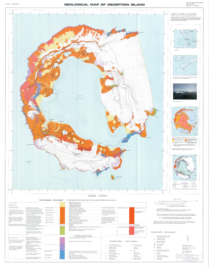
Geologic Map of Deception Island
Deception Island, Antarctica, 2002
Sheet 6-A in: Smellie, J.L., López-Martínez, J., Headland, R.K., Hernández-Cifuentes, F., Maestro, A., Millar, I.L., Rey, J., Serrano, E., Somoza, L., & Thomson, J.W. (2002). Geology and geomorphology of Deception Island. Cambridge, British Antarctic Survey, 77 p. (BAS Geomap Series, Sheets 6A and 6B).
This map was produced by an official agency, but may not be the most recent, most complete, or main operational map.
For the current operational hazard map, please consult the proper institutional authorities.
Click on image for full-size map. If link seems broken, try the archived version.
Smellie, J.L.; López-Martínez, J.; Headland, R.K.; Hernández-Cifuentes, F.; Maestro, A.; Millar, I.L.; Rey, J.; Serrano, E.; Somoza, L.; Thomson, J.W.. 2002 Geology and geomorphology of Deception Island. Cambridge, British Antarctic Survey, 77 p. (BAS Geomap Series, Sheets 6A and 6B).Map Set
http://nora.nerc.ac.uk/id/eprint/17439/1/BAS%20GEOMAP%206%20-%20Geology%20and%20geomorphology%20of%20Deception%20Island.pdf
Other Maps In Set: