
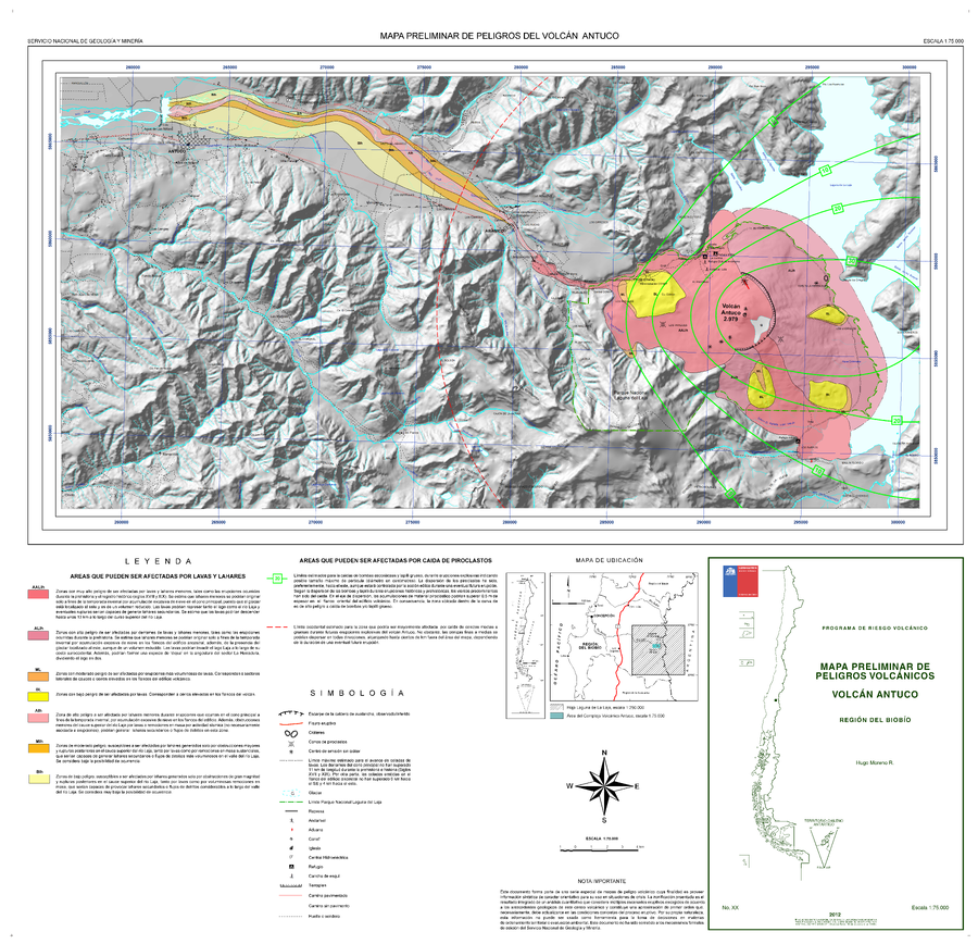
Mapa Preliminar de Peligros del Volcán Antuco
Preliminary Hazard Map of Antuco Volcano
Antuco, Chile, 2012
Moreno, H. (2012). Mapa Preliminar de Peligros del Volcán Antuco Región del Biobio. Servicio Nacional de Geología y Minería (SERNAGEOMIN), mapa escala 1:75,000. Santiago.
This map was produced by an official agency, but is NOT the most recent, most complete, or main operational map.
For the current operational hazard map, please consult the proper institutional authorities.
Click on image for full-size map. If link seems broken, try the archived version.