
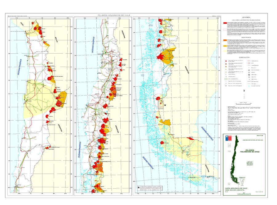
Peligros Volcanicos de Chile
Volcanic Hazards of Chile
Chile (regional), Argentina, Chile, Chile-Argentina, Chile-Bolivia, Chile-Peru, 2011
Lara, L.E., Orozco G., Amigo A. & Silva C. (2011). Peligros Volcanicos de Chile. Servicio Nacional de Geología y Minería (SERNAGEOMIN), Carte Geologica de Chile, Serie Geologia Ambiental, No. 13: 34 p., 1 mapa escala 1:2.000.000. Santiago.
This map was produced by an official agency, but may not be the most recent, most complete, or main operational map.
For the current operational hazard map, please consult the proper institutional authorities.
Click on image for full-size map. If link seems broken, try the archived version.