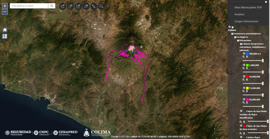
Mapas de Riesgo y Amenaza Volcánica - Atlas de Riesgo de Colima
Risk Maps and Volcanic Threat - Colima Risk Atlas
Colima, Mexico, 2017
Universidad de Colima. (2017). Mapas de Riesgo y Amenaza Volcánica, Atlas de Riesgo de Colima. In: Centro Nacional de Prevención de Desastres (CENAPRED). Atlas Nacional de Riesgos.
This map was produced by an official agency, but may not be the most recent, most complete, or main operational map.
For the current operational hazard map, please consult the proper institutional authorities.

Click on image for full-size map. If link seems broken, try the archived version.
Map Data
Map ID 963 Hazard Process(es) Lahars; PDCs Hazard Zone Presentation Hazard process-focused: Most hazard processes are separated by hazard process type on a main map panel Temporal Scale Background, or long-term, map Spatial Scale User selectable Publication Format Interactive web-based map Zonation Method(s) Scenario modeling Zonation Model(s) LAHARZ or modified version (such as PFZ) (Iverson et al. 1998; Schilling 1998; Schilling 2014); TITAN2D (Pitman et al. 2003; Patra et al. 2005) Scenario(s) Considered Size, VEI, or intensity; Source location or direction Hazard Zone Label(s) Estimated value or Hazard Impact Metric; Scenario name Probability Definition(s) Scenarios imply probability Purpose Multiple: intended for multiple purposes including general hazard awareness, planning, and crisis management Audience General public and/or media Language(s) Spanish Basemap(s) User selectable Basemap overlay(s) Street map Diemsionality Planimetric (2D or map) view Color Scheme Rainbow