← Back to Search Results

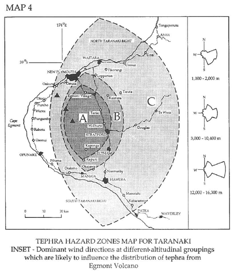
Tephra Hazard Zones Map for Taranaki

Taranaki, New Zealand, 1993

Map 4, Page 25 in: Neall, V.E. & Alloway, B.V. (1993). Volcanic hazards at Egmont volcano. Volcanic Hazards Working Group of the Scientific Advisory Committee, Ministry of Civil Defence. Volcanic Hazards Information Series, Number One, 2nd ed. 31 p.


This map was produced by an official agency, but is NOT the most recent, most complete, or main operational map. For the current operational hazard map, please consult the proper institutional authorities.

Map Set

Neall, V.E. & Alloway, B.V. (1993). Volcanic hazards at Egmont volcano. Volcanic Hazards Working Group of the Scientific Advisory Committee, Ministry of Civil Defence. Volcanic Hazards Information Series, Number One, 2nd ed. 31 p.

Other Maps In Set:

Map Data

Map ID986
Hazard Process(es)Tephra fall
Hazard Zone PresentationSingle hazard: A single hazard process is represented on a main map panel
Temporal ScaleBackground, or long-term, map
Spatial ScaleVolcano and surrounding area
Publication FormatFigure in a hazard assessment or mitigation plan
Zonation Method(s)Geologic history
Zonation Model(s)
Scenario(s) ConsideredSeason or weather; Size, VEI, or intensity; Specific past eruption
Hazard Zone Label(s)Estimated value or Hazard Impact Metric
Probability Definition(s)No probability definition was discernable from the map
PurposeHazard awareness: Intended for educating the audience about the extent and probability of volcanic hazard
AudienceGeneral public and/or media
Language(s)English
Basemap(s)Simple or sketch map
Basemap overlay(s)Street map
DiemsionalityPlanimetric (2D or map) view
Color SchemeDark to Light (greyscale)
Go to Global Volcanism Program page for Taranaki →