
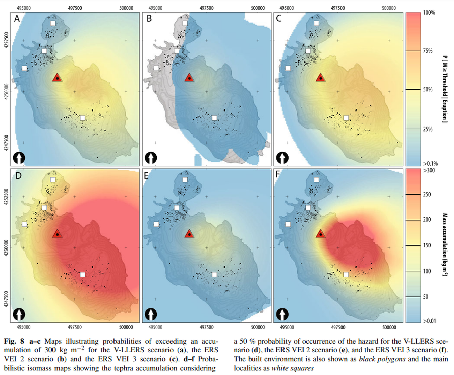
Maps illustrating probabilities of exceeding an accumulation of 300 kg m−2 for the V-LLERS scenario. Probabilistic isomass maps showing the tephra accumulation considering a 50 % probability of occurrence of the hazard for the V-LLERS scenario.
Vulcano, Italy, 2016
Figure 8 in: Biass, S., Bonadonna, C., Di Traglia, F., Pistolesi, M., Rosi, M., & Lestuzzi, P. (2016). Probabilistic evaluation of the physical impact of future tephra fallout events for the Island of Vulcano, Italy. Bulletin of Volcanology, 78(5), 1-22. https://doi.org/10.1007/s00445-016-1028-1
This hazard map is the result of scientific research and was published in academic literature.
It is presented here to serve as an example of the map type or the map-making methodology. It is NOT the official, operational map. For the current operational hazard map, please consult the proper institutional authorities.
Click on thumbnail for full-size map. We do not have copyright permission to display the full-size image. If you are the copyright holder and wish to provide copyright, please contact us at admin@volcanichazardmaps.org. If link seems broken, try the archived version.