
Advanced Search for Maps
Showing 1-4 of 4
Official, Insert/poster-size map with accompanying report
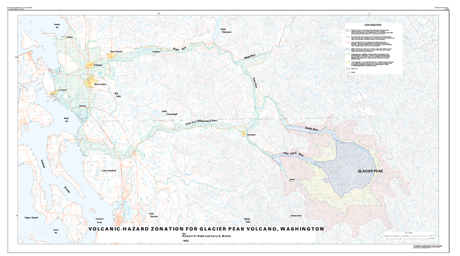
Volcanic-Hazard Zonation For Glacier Peak Volcano, Washington
Plate 1 in: Waitt, R.B., Mastin, L.G., & Begét, J.E. (1995). Volcanic-Hazard Zonation for Glacier Peak Volcano, Washington. U.S. Geological Survey, Open-File Report 95-499, 9 p., 1 plate. https://doi.org/10.3133/ofr95499
Official, Insert/poster-size map with accompanying report
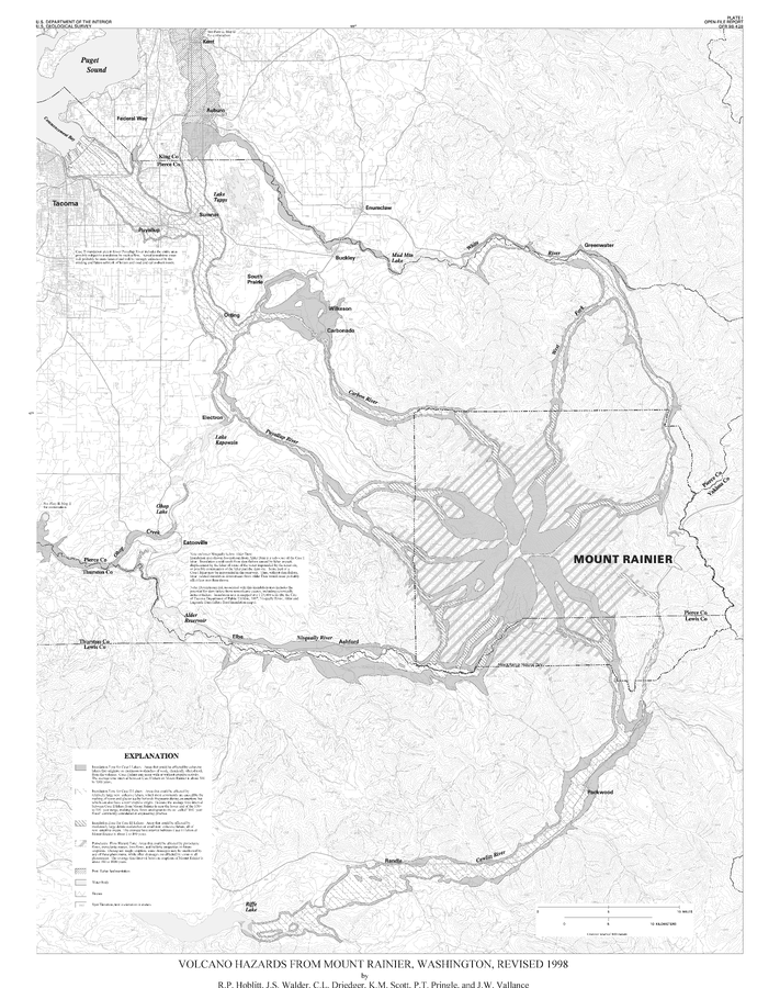
Volcano Hazards From Mount Rainier, Washington, Revised 1998
Plate 1 in: Hoblitt, R.P., Walder, J.S., Driedger, C., Scott, K., Pringle, P.T. & Vallance, J.W. (1998). Volcano Hazards from Mount Rainier, Washington, Revised 1998. U.S. Geological Survey, Open-File Report 98-428, 11 p., 2 plates. https://doi.org/10.3133/ofr98428
Official, Insert/poster-size map with accompanying report
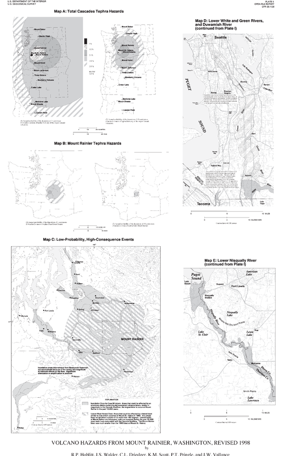
Volcano Hazards From Mount Rainier, Washington, Revised 1998
Plate 2 in: Hoblitt, R.P., Walder, J.S., Driedger, C., Scott, K., Pringle, P.T. & Vallance, J.W. (1998). Volcano Hazards from Mount Rainier, Washington, Revised 1998. U.S. Geological Survey, Open-File Report 98-428, 11 p., 2 plates. https://doi.org/10.3133/ofr98428
Official, Insert/poster-size map with accompanying report
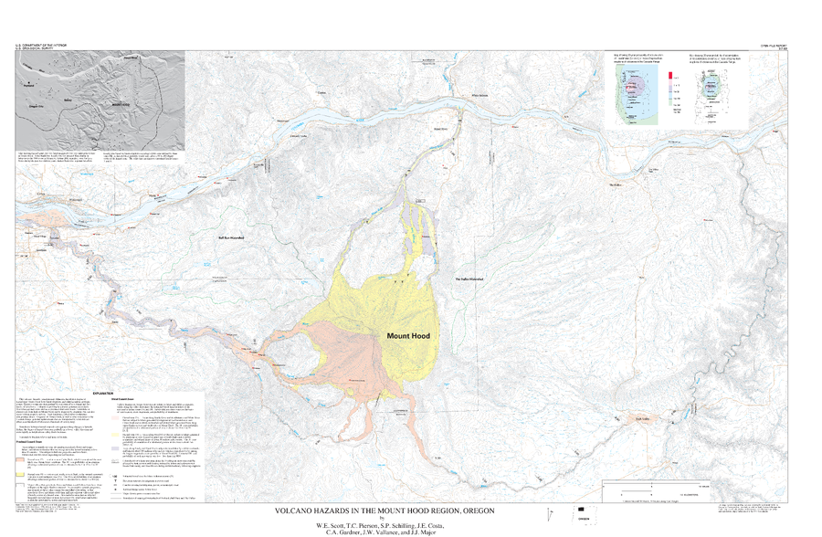
Volcano Hazards in the Mount Hood Region, Oregon
Plate Of1997 in: Scott, W.E., Pierson, T., Schilling, S.P., Costa, J., Gardner, C., Vallance, J.W. & Major, J. (1997). Volcano hazards in the Mount Hood region, Oregon. U.S. Geological Survey, Open-File Report 97-89, 14 p., 1 map. https://doi.org/10.3133/ofr9789