
Advanced Search for Maps
Showing 1-2 of 2
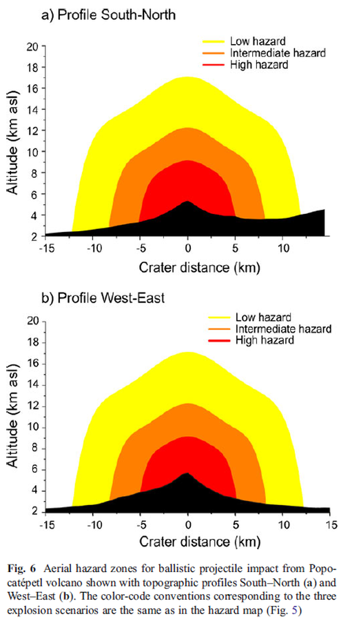
Figure in a journal article
Aerial hazard zones for ballistic projectile impact from Popocatépetl volcano shown with topographic profiles
Figure 6 in: Alatorre-Ibargüengoitia, M. A., Delgado-Granados, H., & Dingwell, D. B. (2012). Hazard map for volcanic ballistic impacts at Popocatépetl volcano (Mexico). Bulletin of Volcanology, 74(9), p. 2155-2169. https://doi.org/10.1007/s00445-012-0657-2
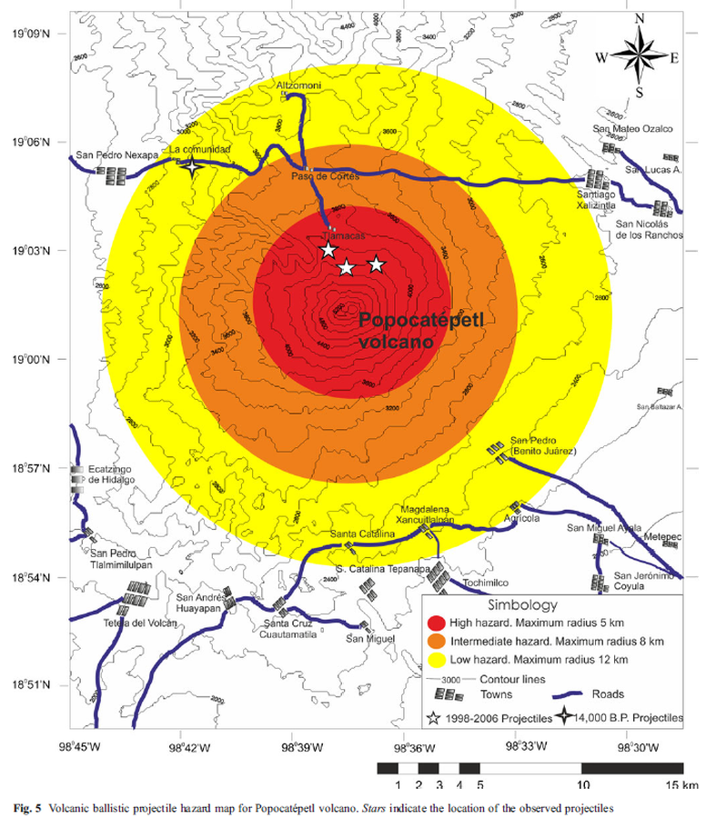
Figure in a journal article
Volcanic ballistic projectile hazard map for Popocatépetl volcano
Figure 5 in: Alatorre-Ibargüengoitia, M. A., Delgado-Granados, H., & Dingwell, D. B. (2012). Hazard map for volcanic ballistic impacts at Popocatépetl volcano (Mexico). Bulletin of Volcanology, 74(9), p. 2155-2169. https://doi.org/10.1007/s00445-012-0657-2