
Advanced Search for Maps
Showing 1-4 of 4
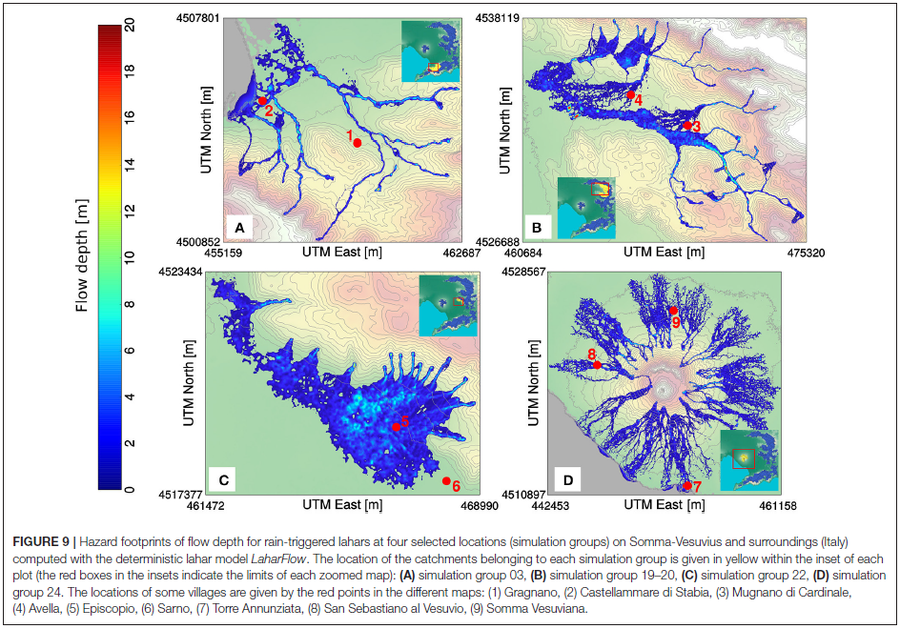
Figure in a journal article
Hazard footprints of flow depth for rain-triggered lahars at four selected locations (simulation groups) on Somma-Vesuvius and surroundings (Italy) computed with the deterministic lahar model LaharFlow
Figure 9 in: Tierz, P., Woodhouse, M.J., Phillips, J.C., Sandri, L., Selva, J., Marzocchi, W., & Odbert, H.M. (2017). A framework for probabilistic multi-hazard assessment of rain-triggered lahars using Bayesian belief networks. Frontiers in Earth Science, 5 (73). https://doi.org/10.3389/feart.2017.00073
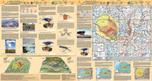
Official, Map sheet or poster
Mapa de Peligros Volcánicos Potenciales del Volcán Guagua Pichincha - 3ra. Edición
(Map of Potential Volcanic Hazards of the Guagua Pichincha Volcano - 3rd. Edition)
IG-EPN, IGM, IRD. (2019). Mapa de Peligros Volcánicos Potenciales del Volcán Guagua Pichincha 3ra. Edición, Quito - Ecuador.
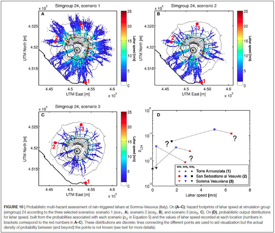
Figure in a journal article
Probabilistic multi-hazard assessment of rain-triggered lahars at Somma-Vesuvius (Italy).
Figure 10 in: Tierz, P., Woodhouse, M.J., Phillips, J.C., Sandri, L., Selva, J., Marzocchi, W., & Odbert, H.M. (2017). A framework for probabilistic multi-hazard assessment of rain-triggered lahars using Bayesian belief networks. Frontiers in Earth Science, 5 (73). https://doi.org/10.3389/feart.2017.00073
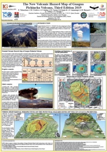
Official, Figure in a conference presentation
The New Volcanic Hazard Map of Guagua Pichincha Volcano, Third Edition 2019
Telenchana, E., Córdova, M., Mothes, P., Espín, P., Samaniego, P., Bernard, B., Vallejo, S., & Proaño A. (2019). The new potential volcanic hazard map of Guagua Pichincha Volcano, Third Edition 2019. 8th International Symposium on Andean Geodynamics (ISAG).