
Volcanic Alert Level (VAL) information is displayed or even linked to hazard zones on some volcanic hazard maps in the IAVCEI Volcanic Hazard Maps database. We can now provide more information about these VALs and VAL systems through the recently developed global Volcanic Alert Level Information Database (VALID).
VALID was built in order to understand, track, and contextualize alert level changes at volcanoes around the world. The database contains information about 92 Volcanic Alert Level (VAL) systems from 32 countries. VAL systems differ in a number of ways, most notably by the way levels are named, the domain that they apply to, and the number of levels in the system.
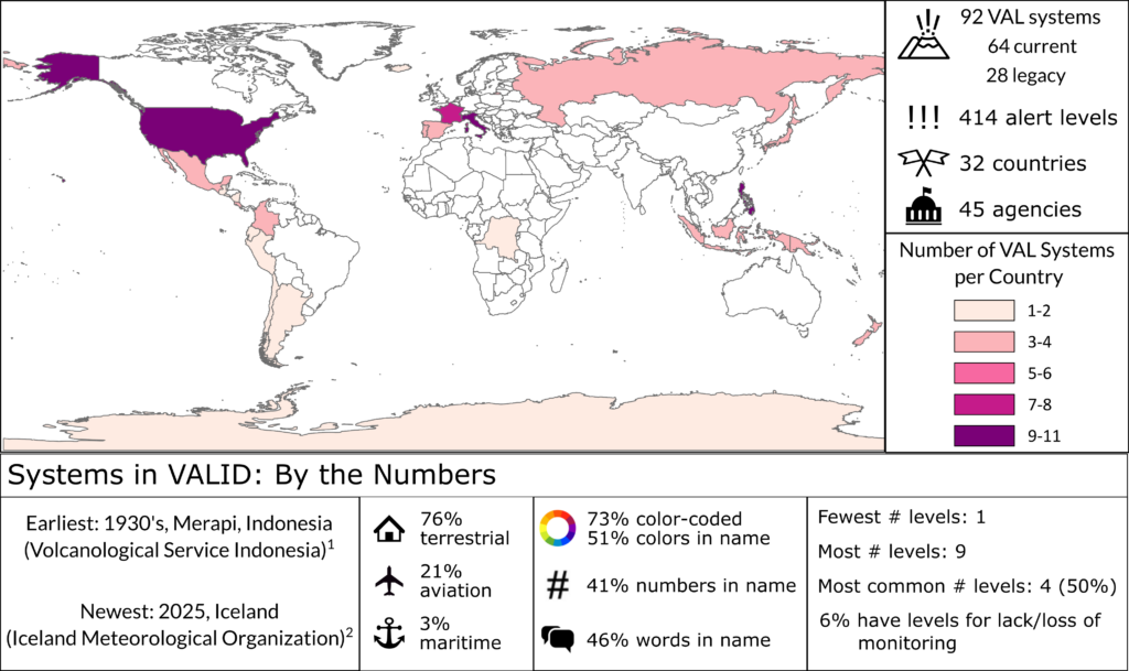
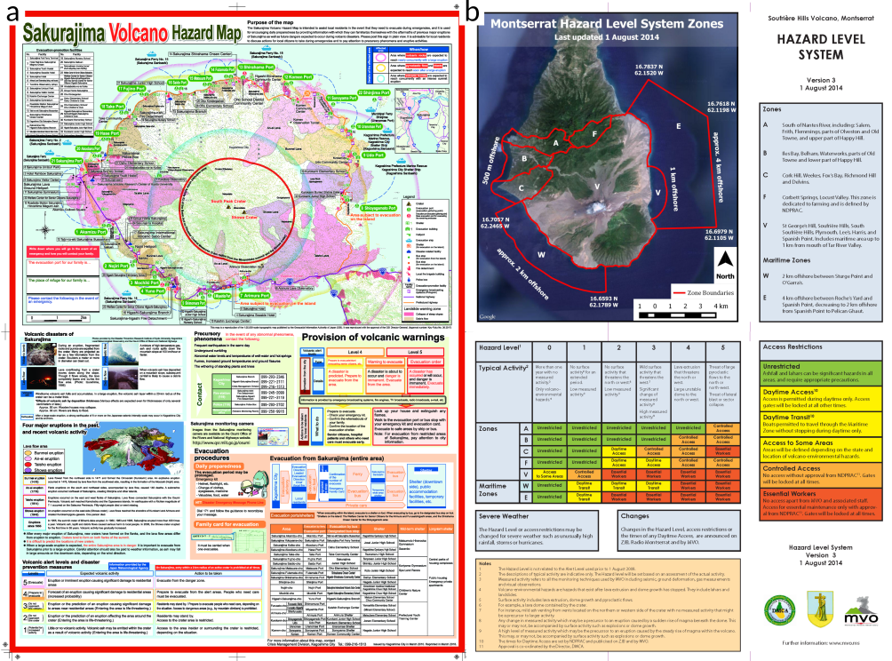
Approximately 29% of VAL systems include links to evacuations, closures, or land use restrictions, with higher alert levels triggering these actions. In some countries, these VALs are explicitly tied to zones defined on volcanic hazard maps, whereas in others, evacuation maps are issued when VALs are raised to evacuation-triggering levels.
Volcanic hazard maps frequently contain information about VALs even when alert levels are not linked to evacuations. In Iceland, for example, the Icelandic Meteorological Office issues terrestrial alert levels on crisis hazard maps (Icelandic Meteorological Office 2025).
Relationships between hazard maps and VAL systems are recorded and can be explored on the VALID and on IAVCEI Volcanic Hazard Maps Database map pages.