
Advanced Search for Maps
Showing 311-320 of 2217
Official, Map in a booklet, long fact-sheet, or handbook
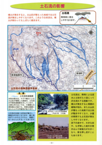
Debris flow dangerous area prediction map
Page 8 in: Nasudake Volcano Disaster Prevention Council. (2010). Volcanic disaster prevention handbook of Mt. Nasudake.
Official, Figure in hazard assessment
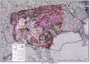
Debris flow possibility map
Figure 5.7.1 in: Mt. Fuji Hazard Map Review Committee. (2004). Mt. Fuji Hazard Map Review Committee Report. June 2004. https://www.bousai.go.jp/kazan/fuji_map/pdf/report_200406.pdf
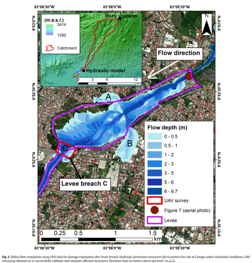
Figure in a journal article
Debris flow simulation using UAV data for damage estimation after levee breach
Figure 5 in: Granados-Bolaños, S., Quesada-Román, A., & Alvarado, G. E. (2021). Low-cost UAV applications in dynamic tropical volcanic landforms. Journal of Volcanology and Geothermal Research, 410, 107143.
Official, Figure in hazard assessment
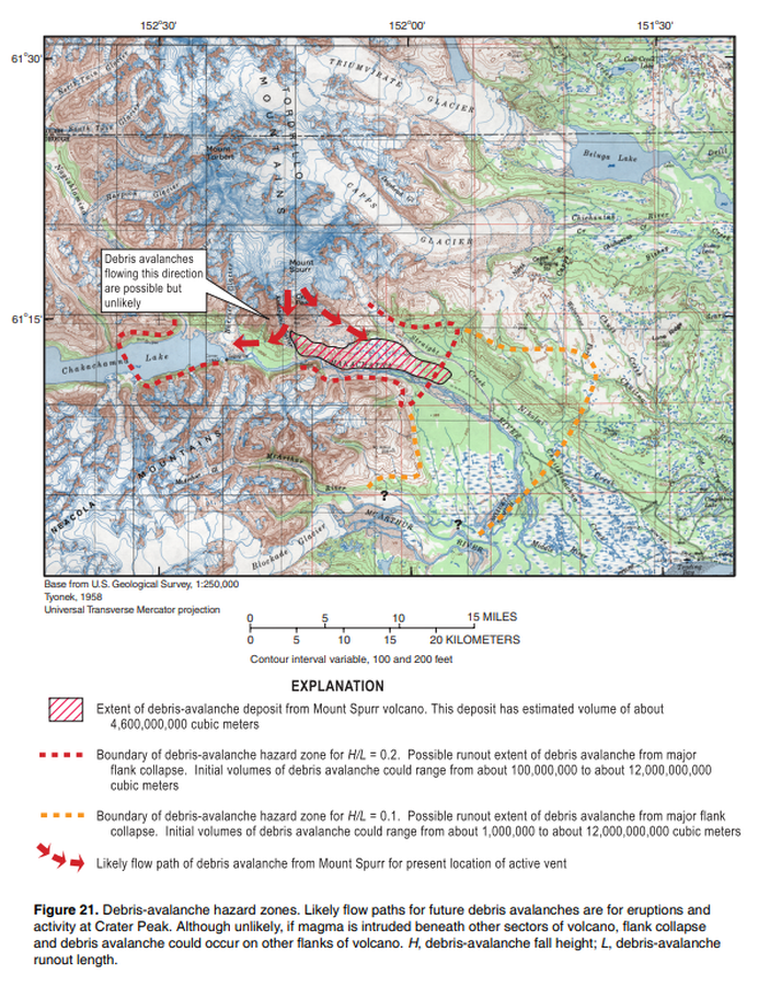
Debris-avalanche hazard zone
Figure 21 in: Waythomas, C.F. & Nye, C.J. (2002). Preliminary volcano-hazard assessment for Mount Spurr Volcano, Alaska. U.S. Geological Survey, Open-File Report 2001-482, 40 p., 1 plate. https://doi.org/10.3133/ofr01482

Official, Interactive web-based map
Delimitación de la zona del volcán reventador
(Delimitation of the zone of Reventador Volcano)
Map 1 in: Instituto Geofísico de la Escuela Politecnica Nacional (IG-EPN). (2023). Volcán Reventador - Mapas de los Peligros Potenciales del volcán Reventador. November 21, 2023. https://www.igepn.edu.ec/mapas/amenaza-volcanica/mapa-volcan-reventador.html

Official, Figure in hazard assessment
Delimitation of Volcanic Danger Areas, Camiguin Island, Dec. 18, 1951
Philippine Geodetic & Geophysical Institute. (1952). A preliminary report on the recent eruptions of Hibok-Hibok volcano, Camiguin Island, Philippines. Bull Volcanol 12, 215–225.

Figure in a journal article
Delineation of impact areas for three VBP diameters ejected during the scenario of a hydrothermal eruption at the Hsiaoyiokeng fumarole
Figure 6 in: Nurmawati, A., & Konstantinou, K. I. (2018). Hazard assessment of volcanic ballistic impacts at Mt Chihshin, Tatun Volcano Group, northern Taiwan. Natural hazards, 92(1), p. 77-92. https://doi.org/10.1007/s11069-018-3192-4
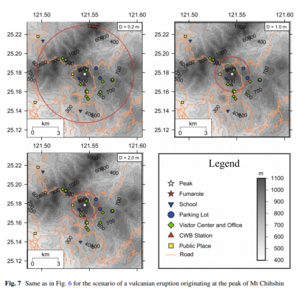
Figure in a journal article
Delineation of impact areas for three VBP diameters ejected during the scenario of a vulcanian eruption originating at the peak of Mt Chihshin
Figure 7 in: Nurmawati, A., & Konstantinou, K. I. (2018). Hazard assessment of volcanic ballistic impacts at Mt Chihshin, Tatun Volcano Group, northern Taiwan. Natural hazards, 92(1), p. 77-92. https://doi.org/10.1007/s11069-018-3192-4
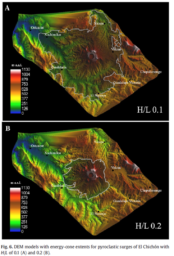
Figure in a journal article
DEM models with energy-cone extents for pyroclastic surges of El Chichón with H/L of 0.1 (A) and 0.2 (B).
Figure 6 in: Macías, J. L., Capra, L., Arce, J. L., Espíndola, J. M., García-Palomo, A., & Sheridan, M. F. (2008). Hazard map of El Chichón volcano, Chiapas, México: Constraints posed by eruptive history and computer simulations. Journal of Volcanology and Geothermal Research, 175(4), 444-458. https://doi.org/10.1016/j.jvolgeores.2008.02.023
Official, Figure in hazard assessment
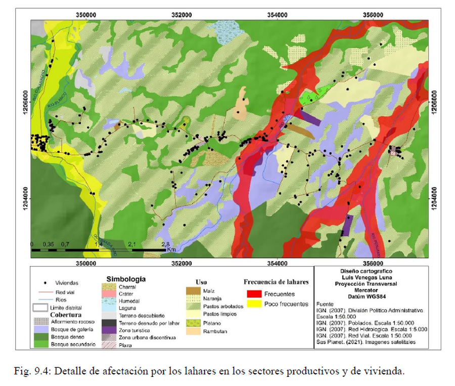
Detalle de afectación por los lahares en los sectores productivos y de vivienda
(Detail of the impact caused by lahars in the productive and housing sectors)
Figure 9.4 in: Alvarado, G.E., Brenes-André, J., Venegas, L., Alpízar, Y., Núñez, S., Sánchez, M., Abarca, K., Abarca, J., Báez, W.A., Sibaja, J.P., Esquivel, L., & Arcia, T. (2022). Análisis del Peligro Volcánico del Rincón de la Vieja, Costa Rica. Instituto Costarricense de Electricidad (ICE). Setiembre 2022.