
Advanced Search for Maps
Showing 261-270 of 2217
Official, Flyer, brochure, short fact-sheet, or handout
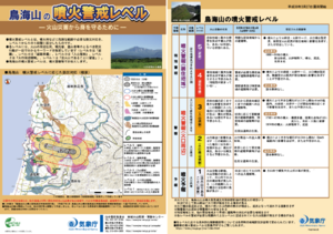
Chokaisan Volcanic Alert Levels
Japan Meteorological Agency. (2018). Chokaisan Volcanic Alert Levels. Volcano Monitoring and Warning Center, Volcano Division, Earthquake and Volcano Department.
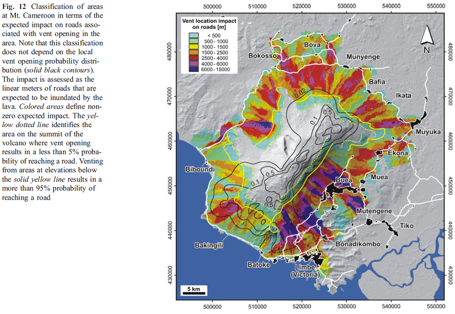
Figure in a journal article
Classification of areas at Mt. Cameroon in terms of the expected impact on roads associated with vent opening in the area
Figure 12 in: Favalli, M., Tarquini, S., Papale, P., Fornaciai, A., & Boschi, E. (2012). Lava flow hazard and risk at Mt. Cameroon volcano. Bulletin of Volcanology, 74(2), 423-439. https://doi.org/10.1007/s00445-011-0540-6
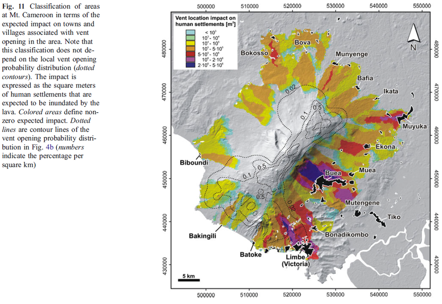
Figure in a journal article
Classification of areas at Mt. Cameroon in terms of the expected impact on towns and villages associated with vent opening in the area
Figure 11 in: Favalli, M., Tarquini, S., Papale, P., Fornaciai, A., & Boschi, E. (2012). Lava flow hazard and risk at Mt. Cameroon volcano. Bulletin of Volcanology, 74(2), 423-439. https://doi.org/10.1007/s00445-011-0540-6
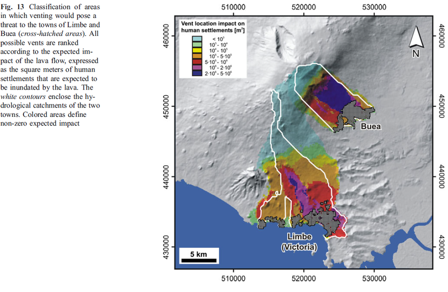
Figure in a journal article
Classification of areas in which venting would pose a threat to the towns of Limbe and Buea
Figure 13 in: Favalli, M., Tarquini, S., Papale, P., Fornaciai, A., & Boschi, E. (2012). Lava flow hazard and risk at Mt. Cameroon volcano. Bulletin of Volcanology, 74(2), 423-439. https://doi.org/10.1007/s00445-011-0540-6
Unknown format
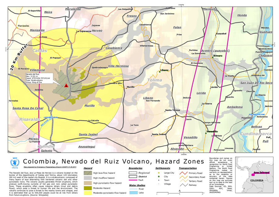
Colombia, Nevado del Ruiz Volcano, Hazard Zones
World Food Programme. (2012). Colombia, Nevado del Ruiz Volcano, Hazard Zones. World Food Programme, Emergency Preparedness Branch (ODEP)
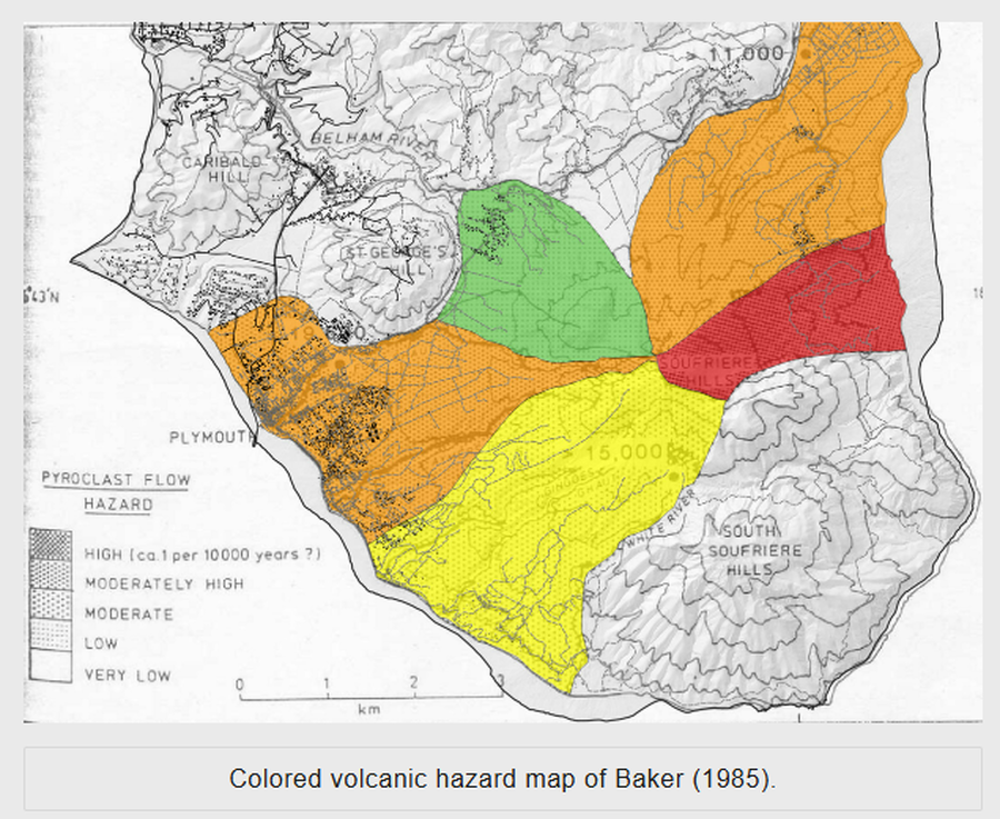
Figure on website
Colored volcanic hazard map of Baker (1985)
Montserrat Volcano Observatory. (2026). Volcanic Hazard-Previous Volcanic Hazard Maps. https://www.mvo.ms/hazards/volcanic-hazard/. Accessed 02-24-2016.
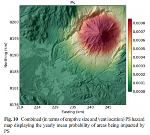
Figure in a journal article
Combined (in terms of eruptive size and vent location) PS hazard map displaying the yearly mean probability of areas being impacted by PS
Figure 10 in: Sandri, L., Thouret, J. C., Constantinescu, R., Biass, S., & Tonini, R. (2014). Long-term multi-hazard assessment for El Misti volcano (Peru). Bulletin of volcanology, 76(2), 771. https://doi.org/10.1007/s00445-013-0771-9
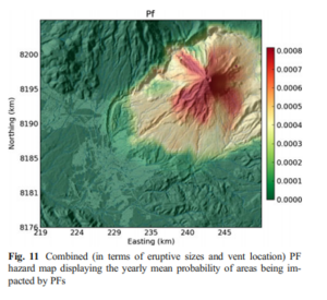
Figure in a journal article
Combined (in terms of eruptive sizes and vent location) PF hazard map displaying the yearly mean probability of areas being impacted by PFs
Figure 11 in: Sandri, L., Thouret, J. C., Constantinescu, R., Biass, S., & Tonini, R. (2014). Long-term multi-hazard assessment for El Misti volcano (Peru). Bulletin of volcanology, 76(2), 771. https://doi.org/10.1007/s00445-013-0771-9
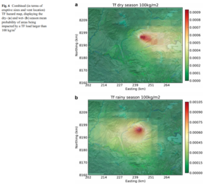
Figure in a journal article
Combined (in terms of eruptive sizes and vent location) TF hazard map, displaying the dry- and wet-season mean probability of areas being impacted by a TF load larger than 100 kg/m²
Figure 6 in: Sandri, L., Thouret, J. C., Constantinescu, R., Biass, S., & Tonini, R. (2014). Long-term multi-hazard assessment for El Misti volcano (Peru). Bulletin of volcanology, 76(2), 771. https://doi.org/10.1007/s00445-013-0771-9
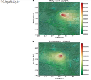
Figure in a journal article
Combined (in terms of eruptive sizes and vent location) TF hazard map, displaying the dry- and wet-season mean probability of areas being impacted by a TF load larger than 250 kg/m²
Figure 7 in: Sandri, L., Thouret, J. C., Constantinescu, R., Biass, S., & Tonini, R. (2014). Long-term multi-hazard assessment for El Misti volcano (Peru). Bulletin of volcanology, 76(2), 771. https://doi.org/10.1007/s00445-013-0771-9