
Advanced Search for Maps
Showing 11-20 of 1482
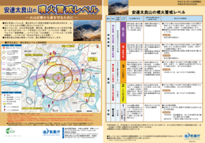
Official, Flyer, brochure, short fact-sheet, or handout
Adatarayama Volcanic Alert Levels
Japan Meteorological Agency. (2019). Adatarayama Volcanic Alert Levels. Volcano Monitoring and Warning Center, Volcano Division, Earthquake and Volcano Department.
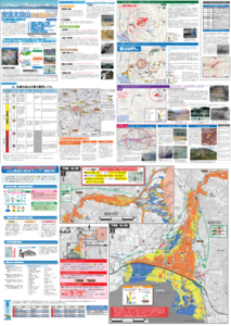
Official, Map sheet or poster
Adatarayama Volcano Disaster Prevention Map [Fukushima City]
Inawashiro Town. (2016). Adatarayama Volcano Disaster Prevention Map [Inawashiro Town].
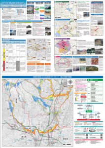
Official, Map sheet or poster
Adatarayama Volcano Disaster Prevention Map [Koriyama City]
Koriyama City. (2016). Adatarayama Volcano Disaster Prevention Map [Koriyama City].
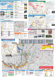
Official, Map sheet or poster
Adatarayama Volcano Disaster Prevention Map [Motomiya City]
Motomiya City. (2016). Adatarayama Volcano Disaster Prevention Map [Motomiya City].
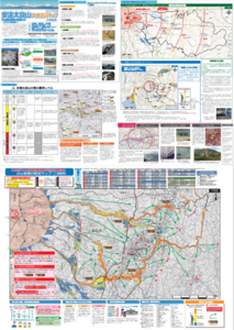
Official, Map sheet or poster
Adatarayama Volcano Disaster Prevention Map [Nihonmatsu City]
Nihonmatsu City. (2016). Adatarayama Volcano Disaster Prevention Map [Nihonmatsu City].
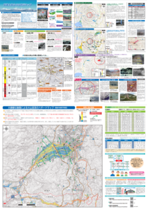
Official, Map sheet or poster
Adatarayama Volcano Disaster Prevention Map [Otama Village]
Fukushima City. (2016). Adatarayama Volcano Disaster Prevention Map [Fukushima City].
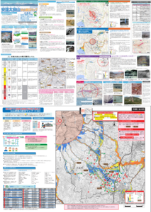
Official, Map sheet or poster
Adatarayama Volcano Disaster Prevention Map [Otama Village]
Otama Village. (2016). Adatarayama Volcano Disaster Prevention Map [Otama Village].
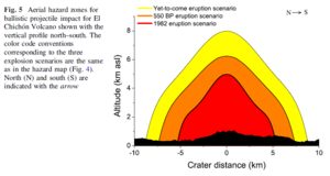
Figure in a journal article
Aerial hazard zones for ballistic projectile impact for El Chichón Volcano shown with the vertical profile north–south
Figure 5 in: Alatorre-Ibargüengoitia, M.A., Morales-Iglesias, H., Ramos-Hernández, S.G., Jon-Selvas, J., & Jiménez-Aguilar, J.M. (2016). Hazard zoning for volcanic ballistic impacts at El Chichón Volcano (Mexico). Natural Hazards, 81(3), p. 1733-1744. https://doi.org/10.1007/s11069-016-2152-0
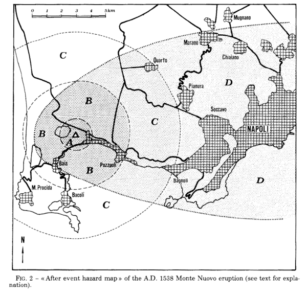
Figure in a journal article
After event hazard map of the A.D. 1538 Monte Nuevo eruption
Figure 2 in: Rosi, M., & Santacroce, R. (1984). Volcanic hazard assessment in the Phlegraean Fields: a contribution based on stratigraphic and historical data. Bulletin Volcanologique, 47(2), p. 359-370. https://doi.org/10.1007/BF01961567
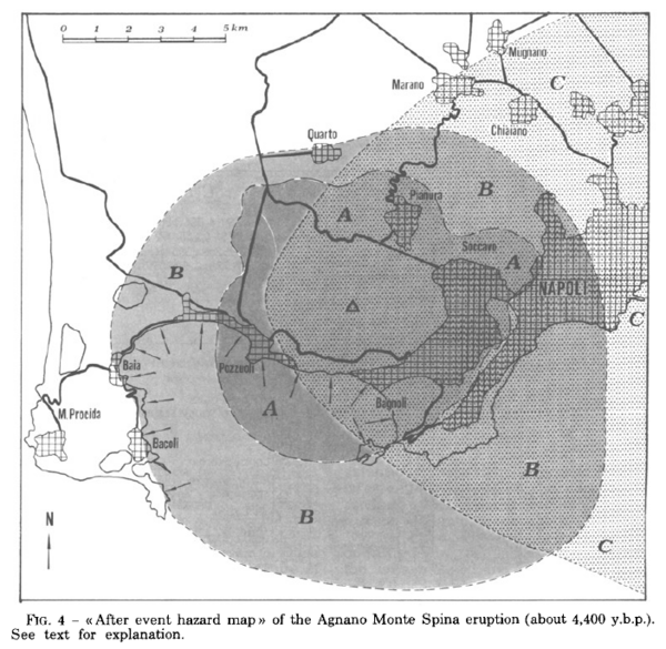
Figure in a journal article
After event hazard map of the Agnano Monte Spina eruption (about 4,400 y.b.p.)
Figure 4 in: Rosi, M. & Santacroce, R. (1984). Volcanic hazard assessment in the Phlegraean Fields: a contribution based on stratigraphic and historical data. Bulletin Volcanologique, 47(2), p. 359-370. https://doi.org/10.1007/BF01961567