
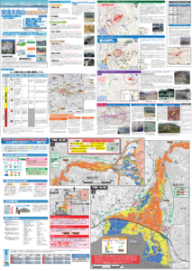
Adatarayama Volcano Disaster Prevention Map [Fukushima City]
Adatarayama, Japan, 2016
Inawashiro Town. (2016). Adatarayama Volcano Disaster Prevention Map [Inawashiro Town].
This map was produced by an official agency, but may not be the most recent, most complete, or main operational map.
For the current operational hazard map, please consult the proper institutional authorities.
Click on thumbnail for full-size map. We do not have copyright permission to display the full-size image. If you are the copyright holder and wish to provide copyright, please contact us at admin@volcanichazardmaps.org. If link seems broken, try the archived version.
Adatarayama Volcano Disaster Prevention Map (2016)Map Set
Other Maps In Set:
Map Data
Map ID 3193 Hazard Process(es) Access or danger zone; Ash-cloud surges; Ballistics; Lahars; PDCs; Tephra fall Hazard Zone Presentation Hazard level- and process-focused: Hazards are both combined by hazard level and separated by hazard process type on a main map and series of insets Temporal Scale Background, or long-term, map Spatial Scale Multiple scales Publication Format Map sheet or poster Zonation Method(s) Derived/simplified from another map Zonation Model(s) Scenario(s) Considered Alert levels; Season or weather; Size, VEI, or intensity; Source location or direction; Style or type Hazard Zone Label(s) Access (exclusion, danger, or safe zones); Estimated value or Hazard Impact Metric; Hazard process name Probability Definition(s) Alert levels imply probability; Qualitative relative probability (e.g. high-medium-low); Scenarios imply probability Purpose Multiple: intended for multiple purposes including general hazard awareness, planning, and crisis management Audience General public and/or media Language(s) Japanese Basemap(s) Contour lines Basemap overlay(s) Contour lines; Street map; Trail or hiking map Diemsionality Planimetric (2D or map) view Color Scheme Red to Blue Volcanic Alert Level System https://global-valid.org/val-japan-20/