Advanced Search for Maps
Showing 11-14 of 14

Figure in a journal article
Maps of the Lolowai area, locations of facilities and services, and potential reuge and pick-up locations form the perspectives of four working groups.
Figure 7 in: Cronin, S.J., Gaylord, D.R., Charley, D., Alloway, B.V., Wallez, S., & Esau, J.W. (2004). Participatory methods of incorporating scientific with traditional knowledge for volcanic hazard management on Ambae Island, Vanuatu. Bulletin of volcanology, 66(7), p. 652-668. https://doi.org/10.1007/s00445-004-0347-9

Unknown format
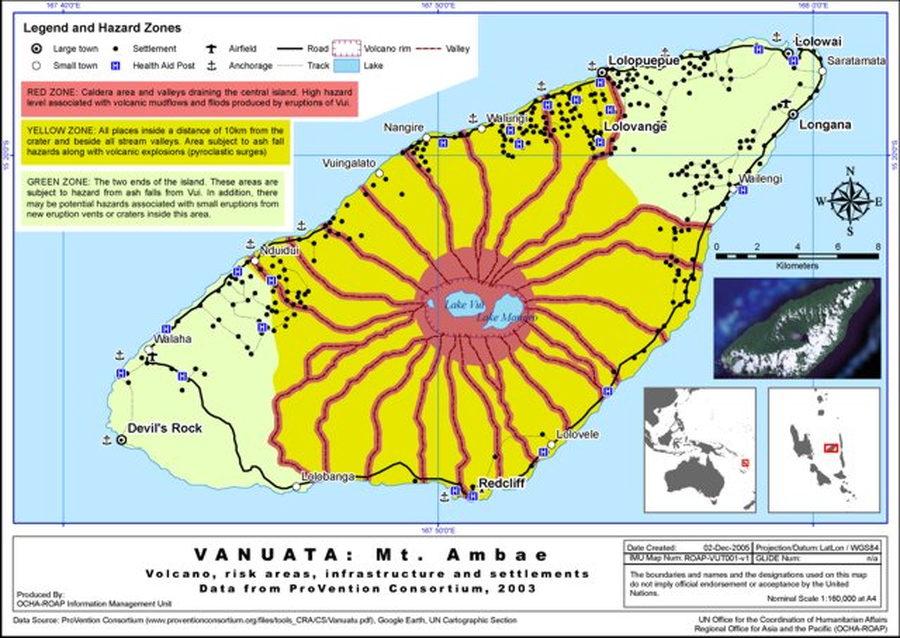
Vanuatu: Mt. Ambae: Volcano, risk areas, infrastructure and settlements data from ProVention Consortium, 2003
United Nations Office for the Coordination of Humanitarian Affairs Asia and the Pacific (UN OCHA-ROAP) Information Management Unit. (2005). Vanuatu: Mt. Ambae Volcano, risk areas, infrastructure and settlements. UN OCHA-ROAP ROAP-VUT001-v1

Official, Figure in hazard assessment
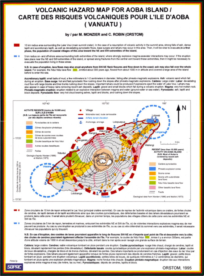
Volcanic Hazard Map for Aoba Island - Carte des Risques Volcaniques pour l'Ile d'Aoba (Vanuatu)
Appendix 1, Page 104 (in reprint) in: Monzier, M. & Robin, C. (1995). Volcanic Hazard Map for Aoba Island - Carte des Risques Volcaniques pour l'Ile d'Aoba (Vanuatu). ORSTOM. (Reprinted in: Esau Wate, J. (2016). National Disaster Management Structure, Volcanic Alert Levels, Emergency Evacuation Plans and Public Awareness Strategies for Vanuatu. In: Taylor, P.W. (Ed.) Volcanic Hazards and Emergency Management in the Southwest Pacific, SPC Technical Bulletin, SPC00017, p. 96-105.)

Official, Flyer, brochure, short fact-sheet, or handout
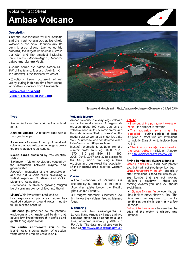
Volcano Fact Sheet Ambae Volcano
Vanuatu Meteorology & Geo-Hazards Department. Volcano Fact Sheet Ambae Volcano. Government of Vanuatu, Vanuatu Meteorology & Geo-Hazards Department, Vanuatu National Disaster Risk Management Office.
Page: 1 2
