
Advanced Search for Maps
Showing 11-14 of 14
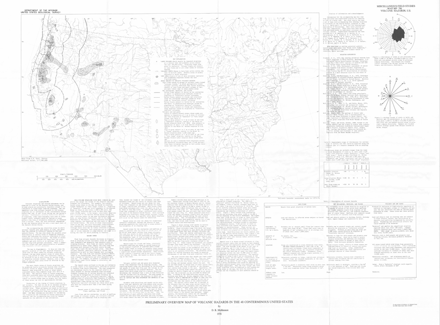
Official, Map sheet or poster
Preliminary Overview Map of Volcanic Hazards in the 48 Coterminous United States
Mullineaux, D.R. (1978). Preliminary overview map of volcanic hazards in the 48 conterminous United States. U.S. Geological Survey, Miscellaneous Field Studies Map 786. https://doi.org/10.3133/mf786
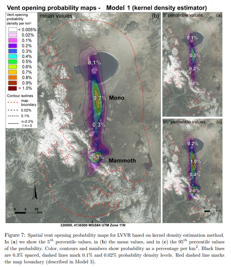
Figure in a journal article
Vent opening probability maps - Model 1 (kernel denisty estimator)
Figure 7 in: Bevilacqua, A., Bursik, M., Patra, A., Pitman, E. B., & Till, R. (2017). Bayesian construction of a long-term vent opening probability map in the Long Valley volcanic region (CA, USA). Statistics in Volcanology, 3(1), 1. http://dx.doi.org/10.5038/2163-338X.3.1
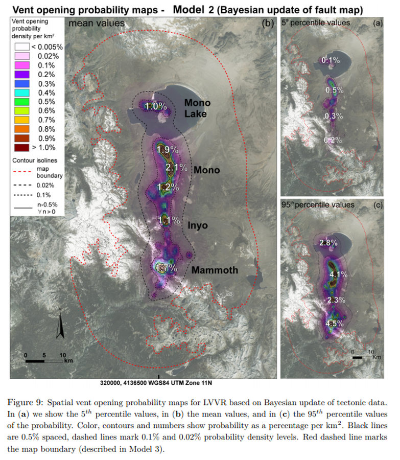
Figure in a journal article
Vent opening probability maps - Model 2 (Bayesian update of fault map)
Figure 9 in: Bevilacqua, A., Bursik, M., Patra, A., Pitman, E. B., & Till, R. (2017). Bayesian construction of a long-term vent opening probability map in the Long Valley volcanic region (CA, USA). Statistics in Volcanology, 3(1), 1. http://dx.doi.org/10.5038/2163-338X.3.1
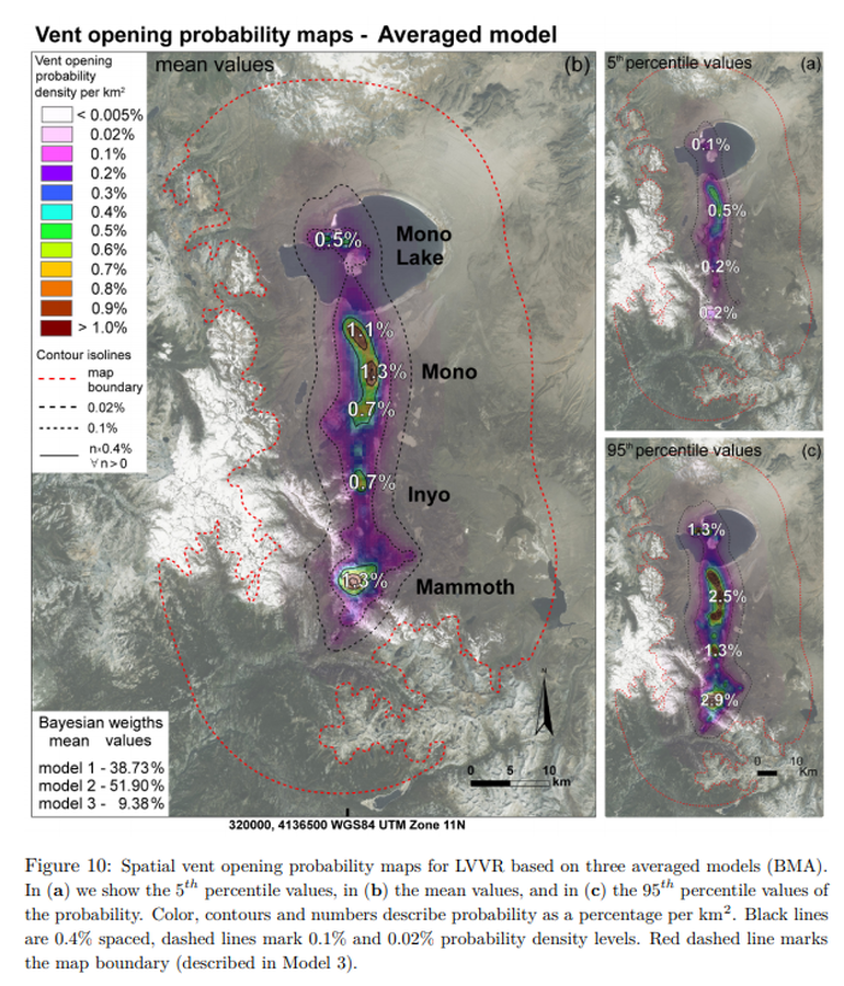
Figure in a journal article
Vent opening probability maps - Model 3 (Averaged model)
Figure 10 in: Bevilacqua, A., Bursik, M., Patra, A., Pitman, E. B., & Till, R. (2017). Bayesian construction of a long-term vent opening probability map in the Long Valley volcanic region (CA, USA). Statistics in Volcanology, 3(1), 1. http://dx.doi.org/10.5038/2163-338X.3.1
Page: 1 2