
Advanced Search for Maps
Showing 1-10 of 252
Official, Figure in a journal article
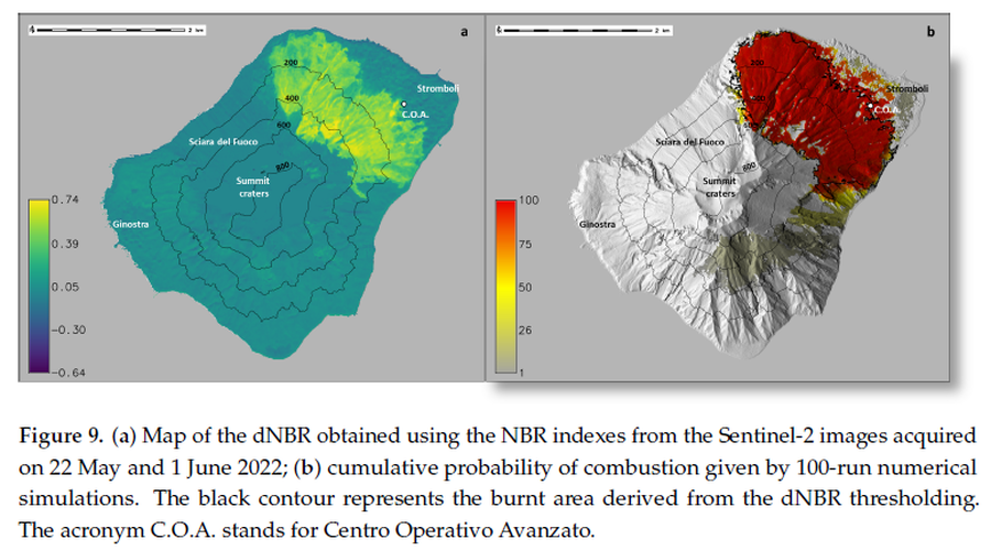
(a) Map of the dNBR obtained using the NBR indexes from the Sentinel-2 images acquired on 22 May and 1 June 2022; (b) cumulative probability of combustion given by 100-run numerical simulations
Figure 9 in: Guardo, R., Bilotta, G., Ganci, G., Zuccarello, F., Andronico, D., & Cappello, A. (2024). Modeling Fire Hazards Induced by Volcanic Eruptions: The Case of Stromboli (Italy). Fire, 7(3), 70.
Official, Figure in a journal article
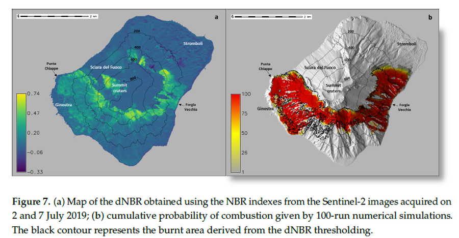
(a) Map of the dNBR obtained using the NBR indexes from the Sentinel-2 images acquired on 2 and 7 July 2019; (b) cumulative probability of combustion given by 100-run numerical simulations
Figure 7 in: Guardo, R., Bilotta, G., Ganci, G., Zuccarello, F., Andronico, D., & Cappello, A. (2024). Modeling Fire Hazards Induced by Volcanic Eruptions: The Case of Stromboli (Italy). Fire, 7(3), 70.
Official, Map sheet or poster
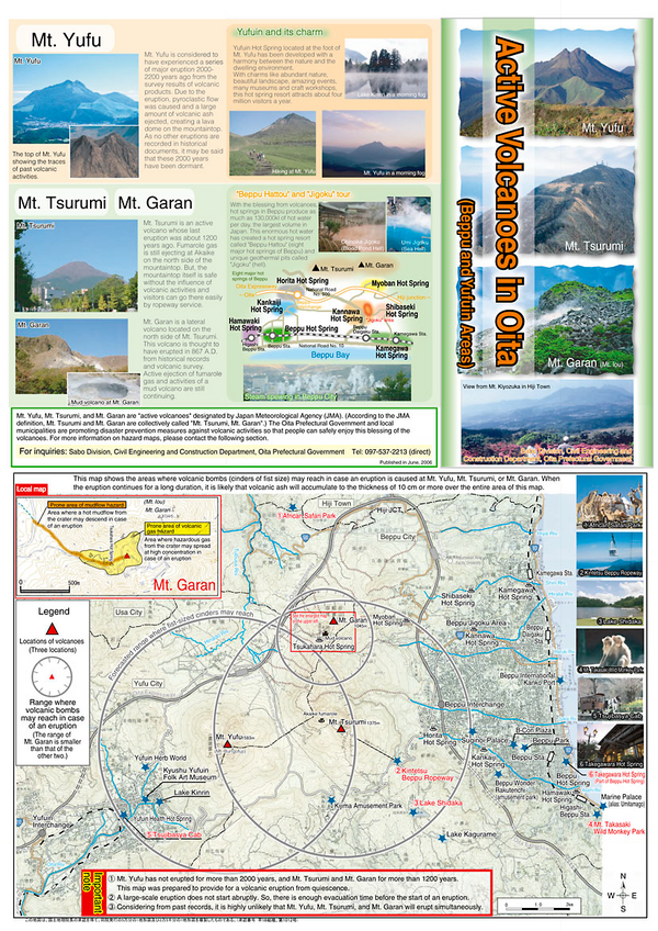
Active Volcanoes in Oita
Oita Prefectural Government. (2006). Active Volcanoes in Oita (Beppu and Yufuin Areas). Sabo Division, Civil Engineering and Construction Department, Oita Prefectural Government.
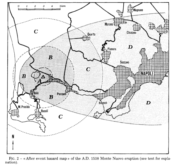
Figure in a journal article
After event hazard map of the A.D. 1538 Monte Nuevo eruption
Figure 2 in: Rosi, M., & Santacroce, R. (1984). Volcanic hazard assessment in the Phlegraean Fields: a contribution based on stratigraphic and historical data. Bulletin Volcanologique, 47(2), p. 359-370. https://doi.org/10.1007/BF01961567
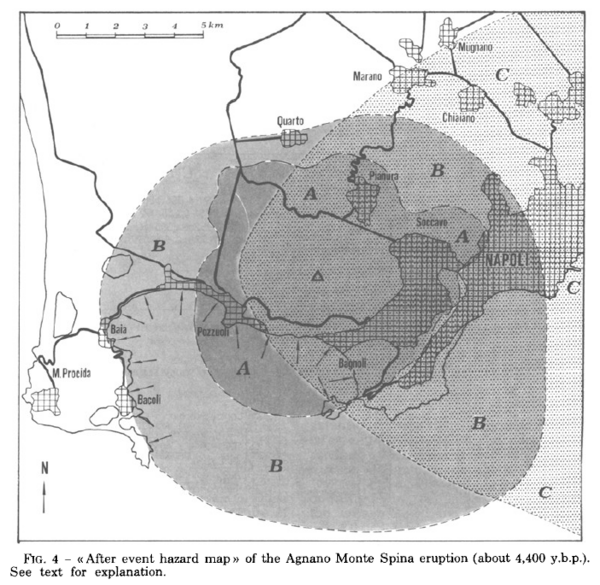
Figure in a journal article
After event hazard map of the Agnano Monte Spina eruption (about 4,400 y.b.p.)
Figure 4 in: Rosi, M. & Santacroce, R. (1984). Volcanic hazard assessment in the Phlegraean Fields: a contribution based on stratigraphic and historical data. Bulletin Volcanologique, 47(2), p. 359-370. https://doi.org/10.1007/BF01961567
Official, Figure in hazard assessment
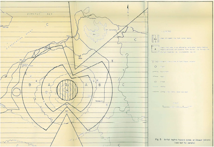
Airfall tephra hazard zones at Ulawun Volcano
Figure 5 in: McKee, C.O. (1983). Volcanic hazards at Uluwan volcano. Geological Survey of Papua New Guinea, Report 83/13, 1:100,000
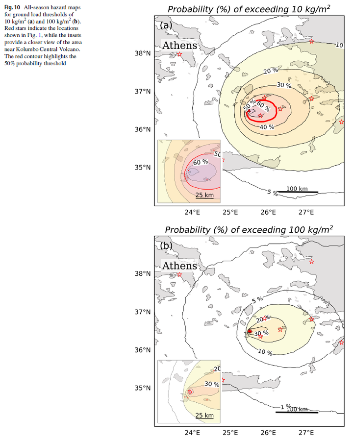
Figure in a journal article
All-season hazard maps for ground load thresholds of 10 kg/m² and 100 kg/m²
Figure 10 in: Pardini, F., Bevilacqua, A., Cerminara, M., Vitturi, M. D. M., Tadini, A., Neri, A., ... & Vougioukalakis, G. (2025). Explosive eruptions of Kolumbo Central Volcano and associated tephra fallout hazards assessment. Bulletin of Volcanology, 87(12), 116. https://doi.org/10.1007/s00445-025-01907-z
Official, Figure in hazard assessment
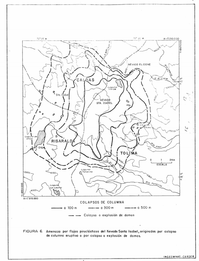
Amenaza por flujos piroclásticos del Nevado Santa Isabel, originados por colapso de columna eruptivo o por colapso o explosión de domos
(Pyroclastic flow hazard of Nevado Santa Isabel, caused by eruption of the eruptive column or by collapse or explosion of domes)
Figure 6 in: Instituto de Investigaciones en Geociencias, Mineria y Quimica (INGEOMINAS). (1993). Mapa Preliminar de Amenaza Volcanica Potencial Complejo de Domos Santa Isabel, Cordillera Central de Colombia. Ibague.
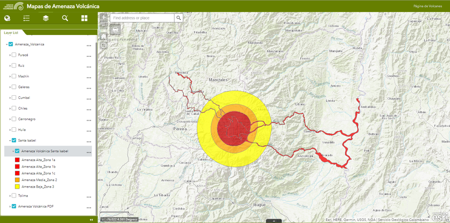
Official, Interactive web-based map
Amenaza Santa Isabel
(Santa Isabel Hazards)
Servicio Geológico Colombiano (SGC). Amenaza Santa Isabel.
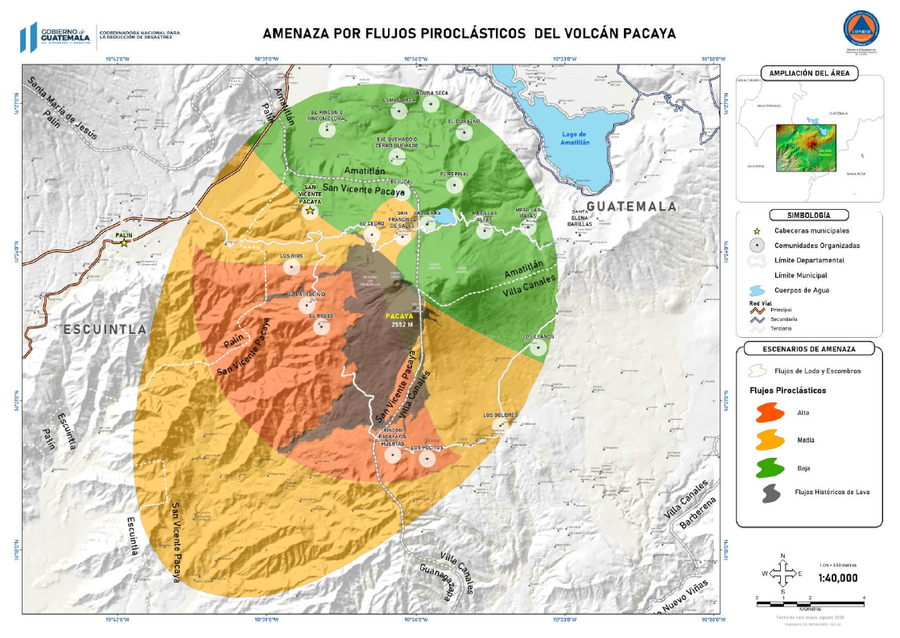
Official, Figure in hazard assessment
Amenazas por Flujos Piroclásticos del Volcán Pacaya
(Hazards from Pyroclastic Flows from Pacaya Volcano)
3.2.1 in: Coordinadora Nacional para la Reducción de Desastres (CONRED). (2021). Protocolo Operativo por Actividad Efusiva del Volcán Pacaya. https://conred.gob.gt/documentos/planes/DRE_20210211_01_PROTOCOLO_OPERATIVO_POR_ACTIVIDAD_EFUSIVA_VOLCAN_PACAYA.pdf