
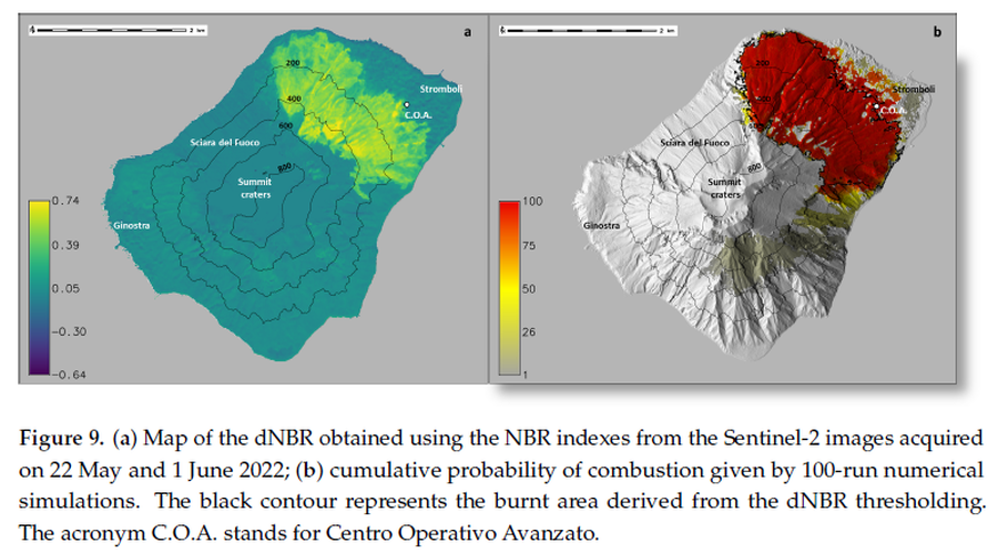
(a) Map of the dNBR obtained using the NBR indexes from the Sentinel-2 images acquired on 22 May and 1 June 2022; (b) cumulative probability of combustion given by 100-run numerical simulations
Stromboli, Italy, 2024
Figure 9 in: Guardo, R., Bilotta, G., Ganci, G., Zuccarello, F., Andronico, D., & Cappello, A. (2024). Modeling Fire Hazards Induced by Volcanic Eruptions: The Case of Stromboli (Italy). Fire, 7(3), 70.
This map was produced by an official agency, but may not be the most recent, most complete, or main operational map.
For the current operational hazard map, please consult the proper institutional authorities.
Click on image for full-size map.
Map Set
Guardo, R., Bilotta, G., Ganci, G., Zuccarello, F., Andronico, D., & Cappello, A. (2024). Modeling Fire Hazards Induced by Volcanic Eruptions: The Case of Stromboli (Italy). Fire, 7(3), 70.
https://doi.org/10.3390/fire7030070
Other Maps In Set: