
Advanced Search for Maps
Showing 1-10 of 93
Official, Figure in a journal article
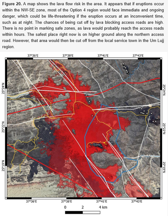
A map shows the lava flow risk in the area
Figure 20 in: Németh, K., Sowaigh, A., Ashor, M., Toni, M., & Sokolov, V. (2026). Volcanic Hazard Assessment of a Monogenetic Volcanic Field with Sporadic and Limited Information: Deterministic Approach for Harrat Lunayyir, Saudi Arabia. GeoHazards, 7(1), 33. https://doi.org/10.3390/geohazards7010033
Official, Figure in a journal article
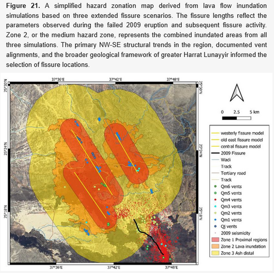
A simplified hazard zonation map derived from lava flow inundation simulations based on three extended fissure scenarios
Figure 21 in: Németh, K., Sowaigh, A., Ashor, M., Toni, M., & Sokolov, V. (2026). Volcanic Hazard Assessment of a Monogenetic Volcanic Field with Sporadic and Limited Information: Deterministic Approach for Harrat Lunayyir, Saudi Arabia. GeoHazards, 7(1), 33. https://doi.org/10.3390/geohazards7010033
Official, Figure on website
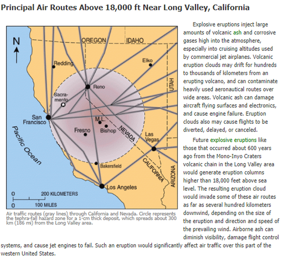
Air traffic routes (gray lines) through California and Nevada. Circle represents the tephra-fall hazard zone for a 1-cm thick deposit, which spreads about 300 km (186 mi) from the Long Valley area.
U.S. Geological Survey (USGS). (2012). Air traffic routes (gray lines) through CA and Nevada. U.S. Geological Survey. Long Valley Caldera Hazards, Principal Air Routes Above 18,000 ft Near Long Valley, California. https://www.usgs.gov/volcanoes/long-valley-caldera/principal-air-routes-above-18000-ft-near-long-valley-california
Official, Map sheet or poster
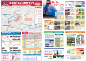
Akita Komagatake Volcano Disaster Prevention Map
Akita Prefecture. (2013). Akita Komagatake Volcano Disaster Prevention Map.
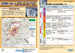
Official, Flyer, brochure, short fact-sheet, or handout
Akita-Komagatake Volcanic Alert Levels
Japan Meteorological Agency. (2016). Akita-Komagatake Volcanic Alert Levels. Volcano Monitoring and Warning Center, Volcano Division, Earthquake and Volcano Department.
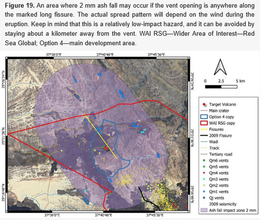
Official, Figure in a journal article
An area where 2 mm ash fall may occur if the vent opening is anywhere along the marked long fissure
Figure 19 in: Németh, K., Sowaigh, A., Ashor, M., Toni, M., & Sokolov, V. (2026). Volcanic Hazard Assessment of a Monogenetic Volcanic Field with Sporadic and Limited Information: Deterministic Approach for Harrat Lunayyir, Saudi Arabia. GeoHazards, 7(1), 33. https://doi.org/10.3390/geohazards7010033
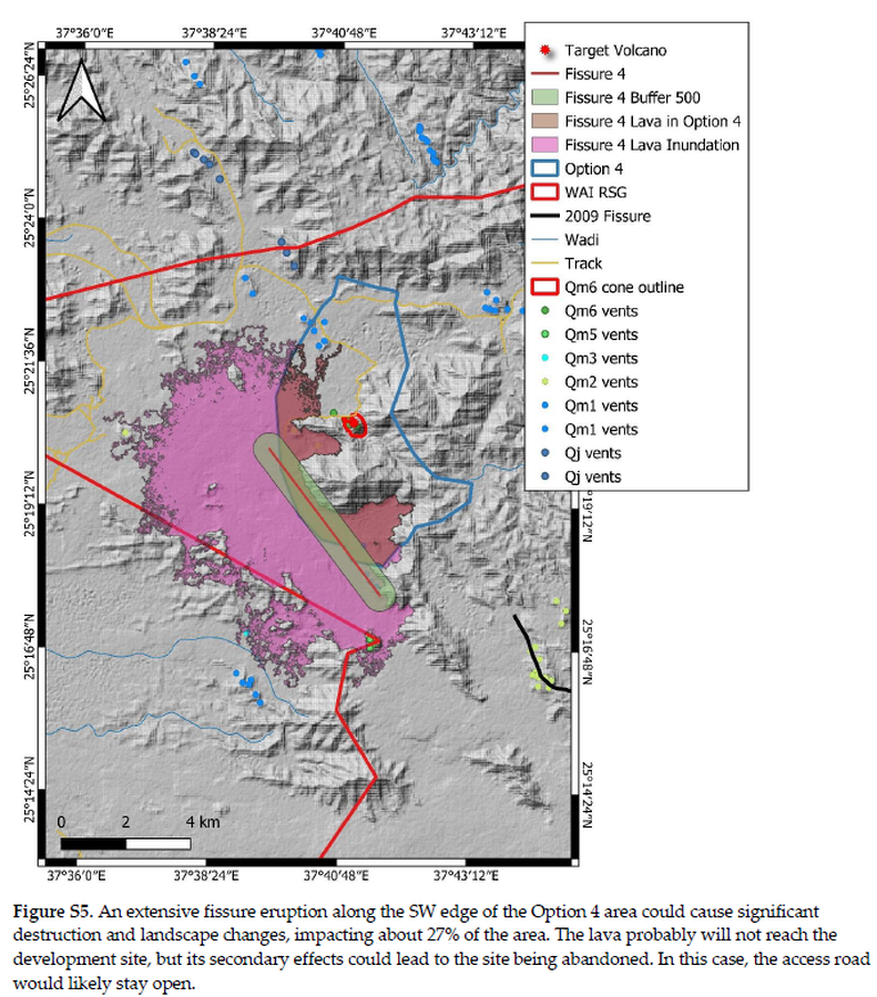
Official, Figure in a journal article
An extensive fissure eruption along the SW edge of the Option 4 area could cause significant destruction and landscape changes
Figure S5 in: Németh, K., Sowaigh, A., Ashor, M., Toni, M., & Sokolov, V. (2026). Volcanic Hazard Assessment of a Monogenetic Volcanic Field with Sporadic and Limited Information: Deterministic Approach for Harrat Lunayyir, Saudi Arabia. GeoHazards, 7(1), 33. https://doi.org/10.3390/geohazards7010033
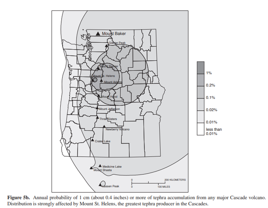
Official, Figure in hazard assessment
Annual probability of 1 cm (about 0.4 inches) or more of tephra accumulation from any major Cascade volcano
Figure 5b in: Gardner, C.A., Scott, K.M., Miller, C.D., Myers, B., Hildreth, W., & Pringle, P.T. (1995). Potential volcanic hazards from future activity of Mount Baker, Washington. U.S. Geological Survey, Open-File Report 95-498, 16 p., 1 plate, scale 1:100,000. https://doi.org/10.3133/ofr95498
Official, Figure in hazard assessment
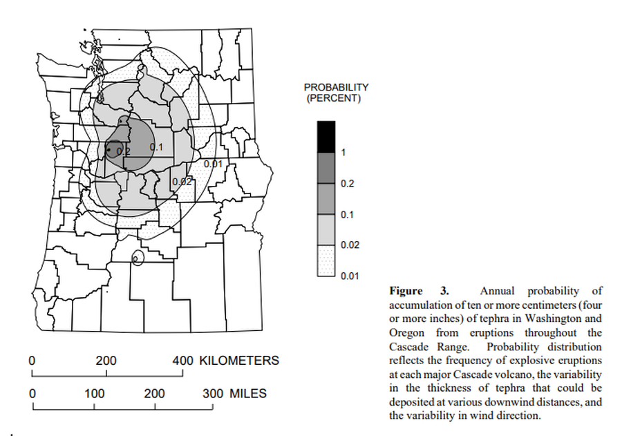
Annual probability of accumulation of ten or more centimeters (four or more inches) of tephra in Washington and Oregon from eruptions throughout the Cascade Range.
Figure 3 in: Wolfe, E.W. & Pierson, T.C. (1995). Volcanic-Hazard Zonation for Mount St. Helens, Washington, 1995. U.S. Geological Survey, Open-File Report 95-497, 12 p., 1 plate. https://doi.org/10.3133/ofr95497
Official, Figure in a journal article
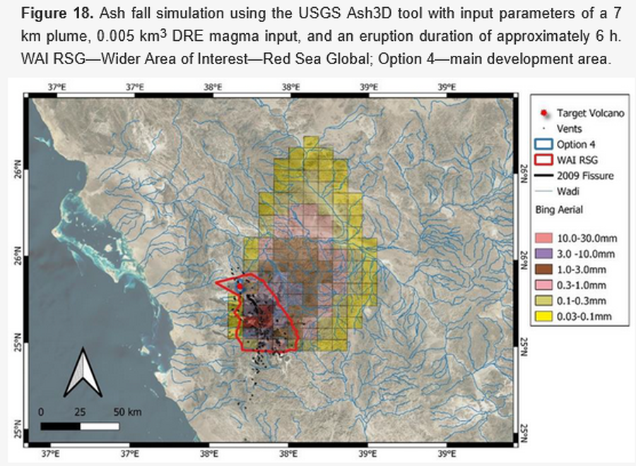
Ash fall simulation using the USGS Ash3D tool
Figure 18 in: Németh, K., Sowaigh, A., Ashor, M., Toni, M., & Sokolov, V. (2026). Volcanic Hazard Assessment of a Monogenetic Volcanic Field with Sporadic and Limited Information: Deterministic Approach for Harrat Lunayyir, Saudi Arabia. GeoHazards, 7(1), 33. https://doi.org/10.3390/geohazards7010033