
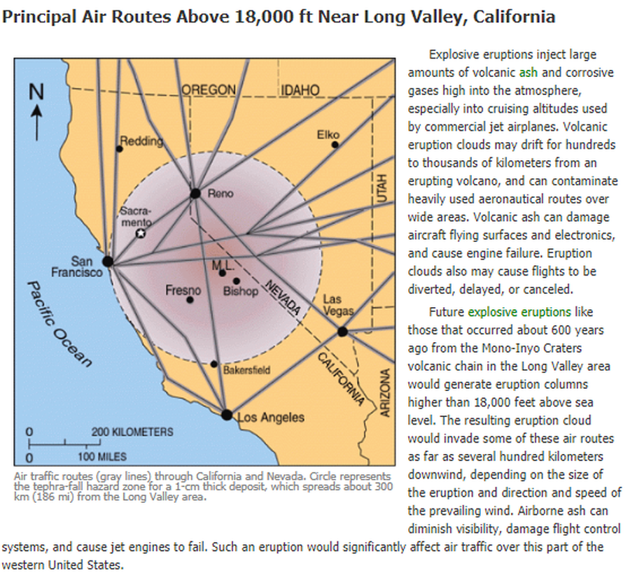
Air traffic routes (gray lines) through California and Nevada. Circle represents the tephra-fall hazard zone for a 1-cm thick deposit, which spreads about 300 km (186 mi) from the Long Valley area.
Long Valley Area, United States, 2012
U.S. Geological Survey (USGS). (2012). Air traffic routes (gray lines) through CA and Nevada. U.S. Geological Survey. Long Valley Caldera Hazards, Principal Air Routes Above 18,000 ft Near Long Valley, California. https://www.usgs.gov/volcanoes/long-valley-caldera/principal-air-routes-above-18000-ft-near-long-valley-california
This map was produced by an official agency, but may not be the most recent, most complete, or main operational map.
For the current operational hazard map, please consult the proper institutional authorities.
Click on image for full-size map. If link seems broken, try the archived version.
U.S. Geological Survey. (2012). Long Valley Caldera, Volcano Hazards in the Long Valley - Mono Lake Area, California. https://www.usgs.gov/volcanoes/long-valley-caldera/volcano-hazards-long-valley-mono-lake-area-california Map Set
https://volcanoes.usgs.gov/volcanoes/long_valley/hazard_hazards.html
Other Maps In Set: