
Advanced Search for Maps
Showing 1-3 of 3
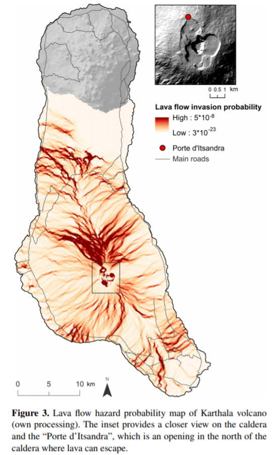
Figure in a journal article
Lava flow hazard probability map of Karthala volcano
Figure 3 in: Mossoux, S., Kervyn, M., & Canters, F. (2019). Assessing the impact of road segment obstruction on accessibility of critical services in case of a hazard. Natural Hazards & Earth System Sciences, 19(6). https://doi.org/10.5194/nhess-19-1251-2019
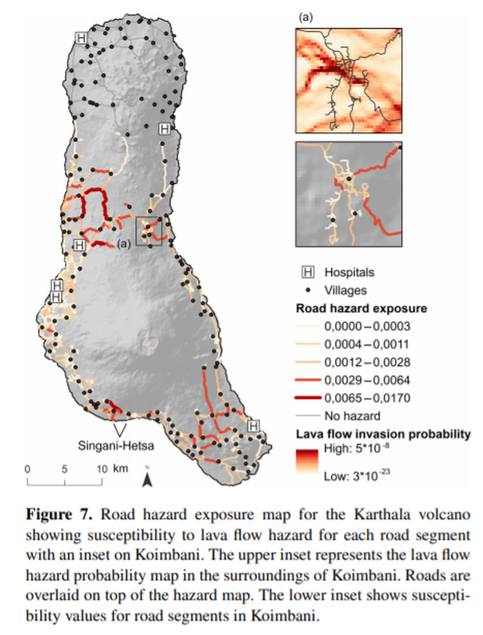
Figure in a journal article
Road hazard exposure map for the Karthala volcano
Figure 7 in: Mossoux, S., Kervyn, M., & Canters, F. (2019). Assessing the impact of road segment obstruction on accessibility of critical services in case of a hazard. Natural Hazards & Earth System Sciences, 19(6). https://doi.org/10.5194/nhess-19-1251-2019
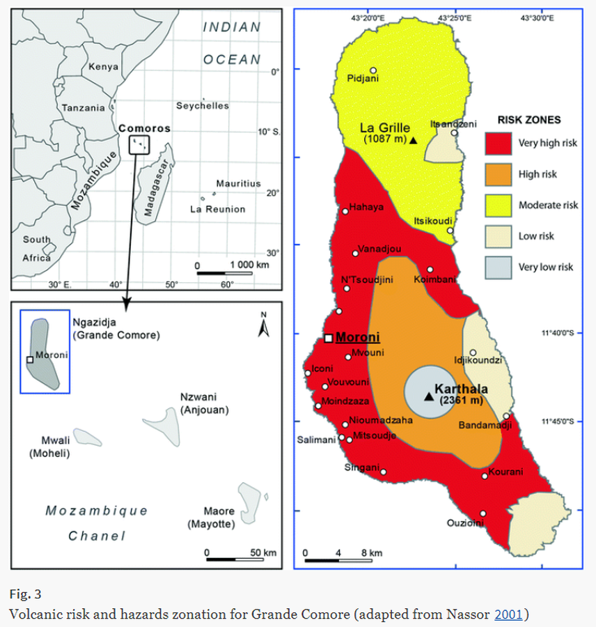
Figure in a journal article
Volcanic risk and hazards zonation for Grande Comore
Figure 3 in: Komorowski JC., Morin J., Jenkins S., & Kelman I. (2016) Challenges of Volcanic Crises on Small Islands States. In: Fearnley C.J., Bird D.K., Haynes K., McGuire W.J., Jolly G. (eds) Observing the Volcano World. Advances in Volcanology. International Association of Volcanology and Chemistry of the Earth’s Interior – IAVCEI. Springer. https://doi.org/10.1007/11157_2015_15. Adapted from: Nassor, H. (2001) Contribution à l’étude du risque volcanique sur les grands volcans boucliers basaltiques: le Karthala et le Piton de la Fournaise, unpublished PhD dissertation, University of La Réunion, 218 p.