
Advanced Search for Maps
Showing 1-4 of 4
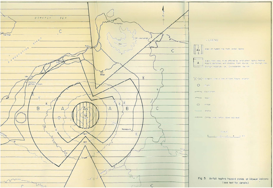
Official, Figure in hazard assessment
Airfall tephra hazard zones at Ulawun Volcano
Figure 5 in: McKee, C.O. (1983). Volcanic hazards at Uluwan volcano. Geological Survey of Papua New Guinea, Report 83/13, 1:100,000
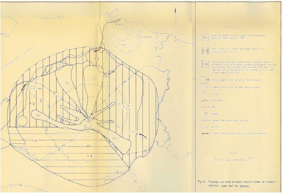
Official, Figure in hazard assessment
Flowage and flank eruption hazard zones at Ulawun Volcano
Figure 6 in: McKee, C.O. (1983). Volcanic hazards at Uluwan volcano. Geological Survey of Papua New Guinea, Report 83/13, 1:100,000
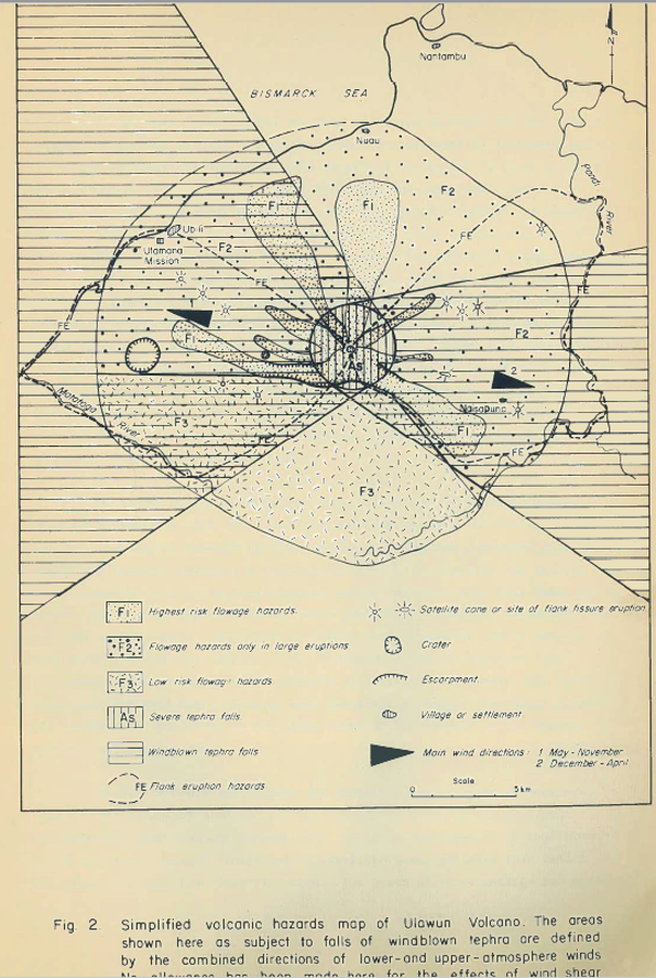
Official, Figure in hazard assessment
Simplified volcanic hazards map of Ulawun Volcano
Figure 2 in: McKee, C.O. (1983). Volcanic hazards at Uluwan volcano. Geological Survey of Papua New Guinea, Report 83/13, 1:100,000
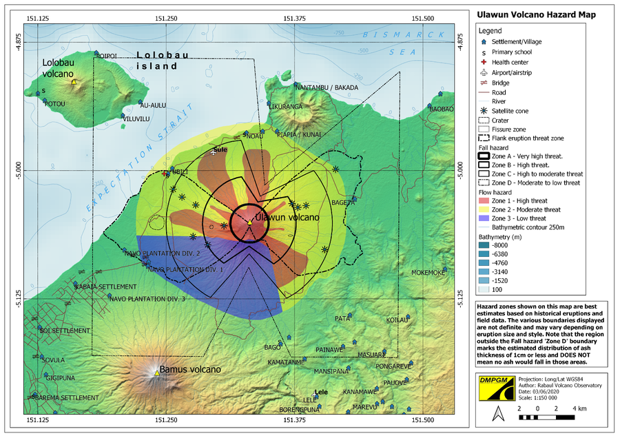
Official, Figure on website
Ulawun Volcano Hazard Map
Rabaul Volcano Observatory (RVO). (2020). Ulawun Volcanic Hazard Map. Department of Mineral Policy and Geohazards Management (DMPGM).