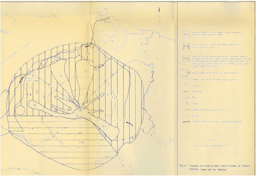
Flowage and flank eruption hazard zones at Ulawun Volcano
Ulawun, Papua New Guinea, 1983
Figure 6 in: McKee, C.O. (1983). Volcanic hazards at Uluwan volcano. Geological Survey of Papua New Guinea, Report 83/13, 1:100,000
This map was produced by an official agency, but is NOT the most recent, most complete, or main operational map.
For the current operational hazard map, please consult the proper institutional authorities.

Click on image for full-size map. If link seems broken, try the archived version.
Map Set
McKee, C.O. (1983). Volcanic hazards at Uluwan volcano. Geological Survey of Papua New Guinea, Report 83/13, 1:100,000
Other Maps In Set:
Map Data
Map ID | 647 |
---|---|
Hazard Process(es) | Flowage hazards; Lahars; Lava flows; PDCs; Vent-opening hazards |
Hazard Zone Presentation | Grouped by process (e.g. flowage/fall hazards) on a main map panel |
Temporal Scale | Background, or long-term, map |
Spatial Scale | Volcano and surrounding area |
Publication Format | Figure in a hazard assessment or mitigation plan |
Zonation Method(s) | Geologic history |
Zonation Model(s) | |
Scenario(s) Considered | No scenarios were discernable from the map |
Hazard Zone Label(s) | Hazard process name; Qualitative relative probability (e.g. high-medium-low) |
Probability Definition(s) | Qualitative relative probability (e.g. high-medium-low) |
Purpose | Multiple: intended for multiple purposes including general hazard awareness, planning, and crisis management |
Audience | Multiple audiences (usually the public, civil authorities, and land-use planners) |
Language(s) | English |
Basemap(s) | Contour lines |
Basemap overlay(s) | Street map |
Diemsionality | Planimetric (2D or map) view |
Color Scheme | Symbols and/or lines only |