
Advanced Search for Maps
Showing 1-2 of 2
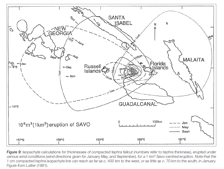
Official, Figure in hazard assessment
Isopachyte calculations for thicknesses of compacted tephra fallout, erupted under various wind conditions, for a 1 km³ Savo-centred eruption
Figure 9 in: Petterson, M.G., Tolia, D., Papabatu, A., Toba, T., & Qoptoto, C. (2016). Volcanic Hazard assessment of Savo Volcano, Solomon Islands, SW Pacific. In: Taylor, P.W. (Ed.) Volcanic Hazards and Emergency Management in the Southwest Pacific, SPC Technical Bulletin, SPC00017, p. 151-169
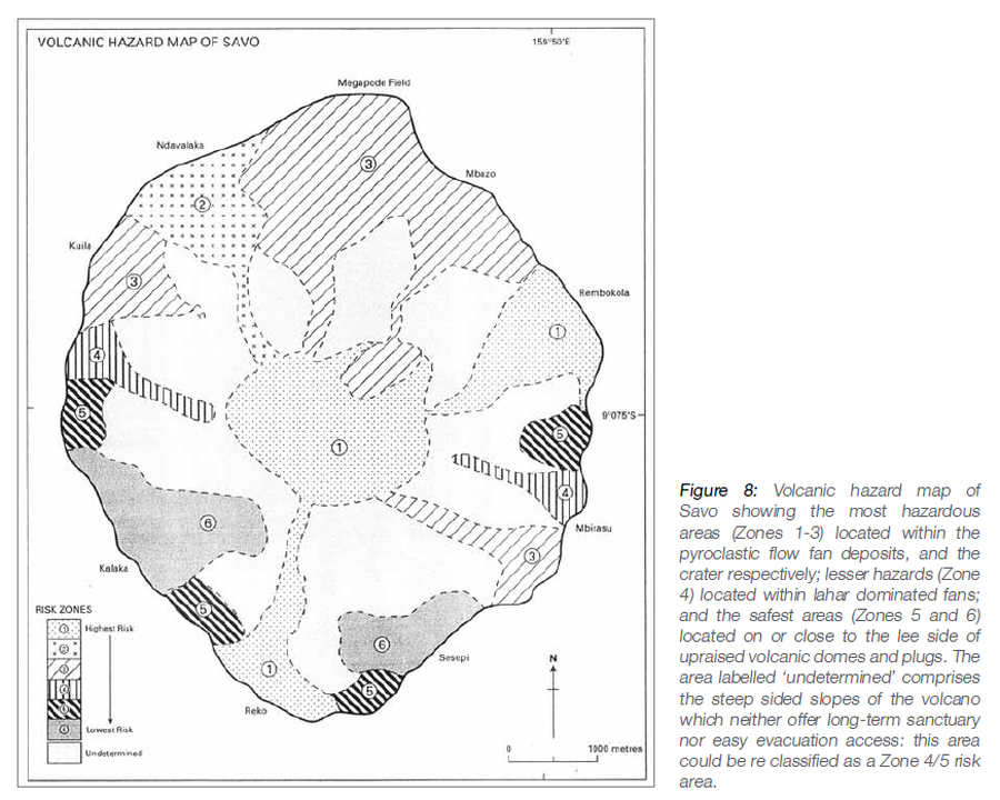
Official, Figure in hazard assessment
Volcanic Hazard Map of Savo
Figure 8 in: Petterson, M.G., Tolia, D., Papabatu, A., Toba, T., & Qoptoto, C. (2016). Volcanic Hazard assessment of Savo Volcano, Solomon Islands, SW Pacific. In: Taylor, P.W. (Ed.) Volcanic Hazards and Emergency Management in the Southwest Pacific, SPC Technical Bulletin, SPC00017, p. 151-169