
Advanced Search for Maps
Showing 1-3 of 3
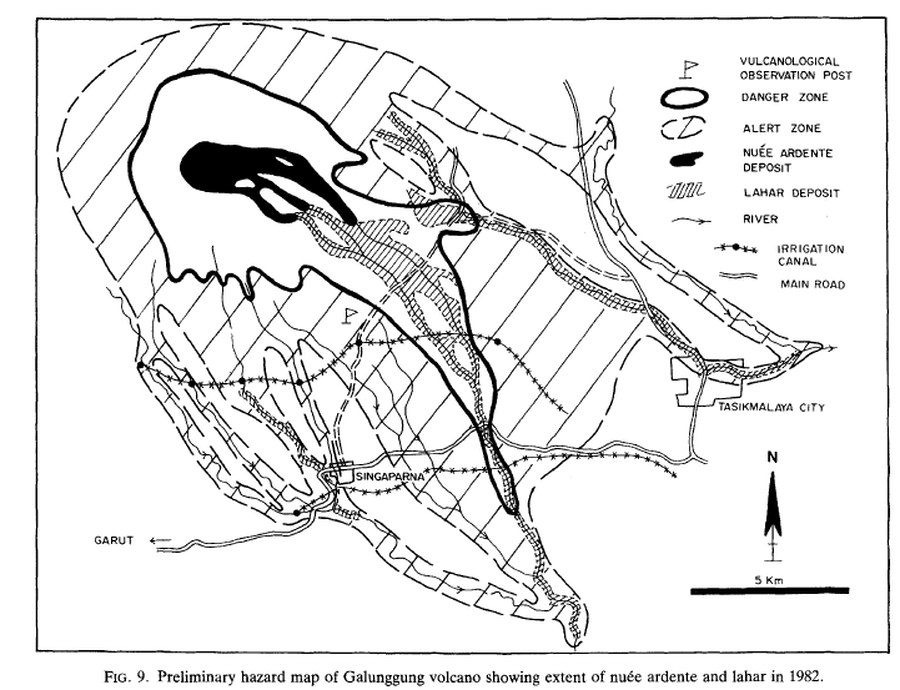
Figure in a journal article
Preliminary hazard map of Galunggung volcano showing extent of nueé ardente and lahar in 1982
Figure 9 in: Suryo, I. & Clarke, M.C.G. (1985). The occurrence and mitigation of volcanic hazards in Indonesia as exemplified at the Mount Merapi, Mount Kelut and Mount Galunggung volcanoes. Quarterly Journal of Engineering Geology and Hydrogeology, 18(1), p. 79-98. https://doi.org/10.1144/GSL.QJEG.1985.018.01.09
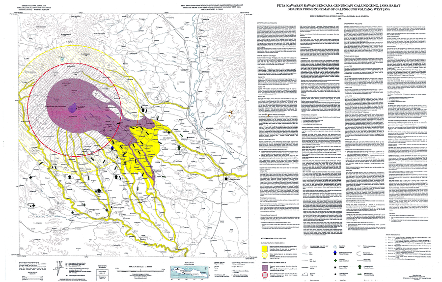
Official, Map sheet or poster
Volcanic Hazard Map of Galunggung Volcano, West Java
Hadisantono, R.D., Bronto, S., Djuhara, A., & Sumpena, A.D. (1996). Volcanic Hazard Map of Galunggung Volcano, West Java. Volcanological Survey of Indonesia (VSI).
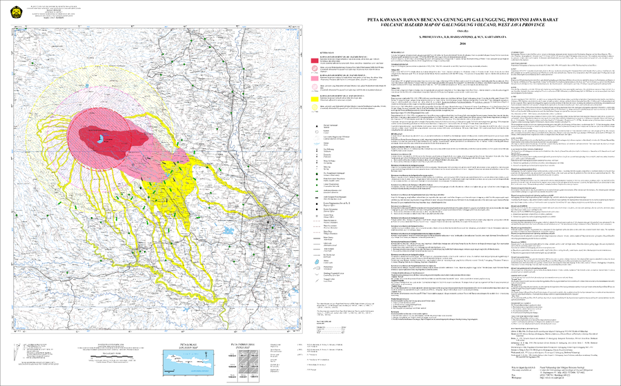
Official, Map sheet or poster
Volcanic Hazard Map of Galunggung Volcano, West Java Province
Primulyana, S., Hadisantono, R.D., & Kartadinata, M.N. (2016). Volcanic Hazard Map of Galunggung Volcano, West Java Province. Center for Volcanology and Geological Hazard Mitigation (CVGHM).