
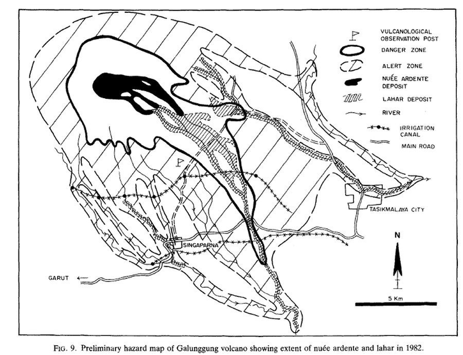
Preliminary hazard map of Galunggung volcano showing extent of nueé ardente and lahar in 1982
Galunggung, Indonesia, 1985
Figure 9 in: Suryo, I. & Clarke, M.C.G. (1985). The occurrence and mitigation of volcanic hazards in Indonesia as exemplified at the Mount Merapi, Mount Kelut and Mount Galunggung volcanoes. Quarterly Journal of Engineering Geology and Hydrogeology, 18(1), p. 79-98. https://doi.org/10.1144/GSL.QJEG.1985.018.01.09
This hazard map is the result of scientific research and was published in academic literature.
It is presented here to serve as an example of the map type or the map-making methodology. It is NOT the official, operational map. For the current operational hazard map, please consult the proper institutional authorities.
Click on image for full-size map.
Map Set
Suryo, I., & Clarke, M.C.G. (1985). The occurrence and mitigation of volcanic hazards in Indonesia as exemplified at the Mount Merapi, Mount Kelut and Mount Galunggung volcanoes. Quarterly Journal of Engineering Geology and Hydrogeology, 18(1), p. 79-98. https://doi.org/10.1144/GSL.QJEG.1985.018.01.09
https://doi.org/10.1144/GSL.QJEG.1985.018.01.09
Other Maps In Set: